 |
| A lovely, windy climb up Chicanery |
The City of La Crosse, in collaboration over the years with Human Powered Trails followed by ORA (Outdoor Recreation Alliance), has a large complex of fairly short trails in Upper and Lower Hixon Forest. There are over 20 miles of trails for hiking and mountain biking. Some of the trails are shared and some hike only. They provide a year-round series of interesting combinations that take you up, down, and around and around the beautiful Hixon Forest.
I was introduced to this particular combination of trails by my friend Kris Lawson. An avid hiker and WI Master Naturalist volunteer, she has an unerring sense of direction and was a great guide.
This particular loop gives you plenty of switchbacks, rolling hills, lush hillsides full of ferns, fungi and forests, ravines and lovely random rocks along the bluffsides. It's 2.5-2.7 miles depending on your ending and you gain 308 total feet in elevation. The trails can be narrow. Be aware of bike traffic especially on weekends. This is also a great snowshoe trail.
 |
| Access this city map here |
The hike starts of County FA behind the NOAA weather station whose radar is affectionately referred to as "the weatherball." You can't miss it's great white radar apparatus crowning the Hixon Forest bluff. Once parked, you see a pump track near picnic tables behind the weatherball. Your trail starts just west of that area.
Head down the narrow and slightly eroded path and take a right at the junction onto Prairie Loop (I know, I couldn't bring myself to include this short segment in the title above). Follow that until you come to a trail intersection (9) for Twister. Turn left on it and follow it a short way to Still Hill (10) and take another left.
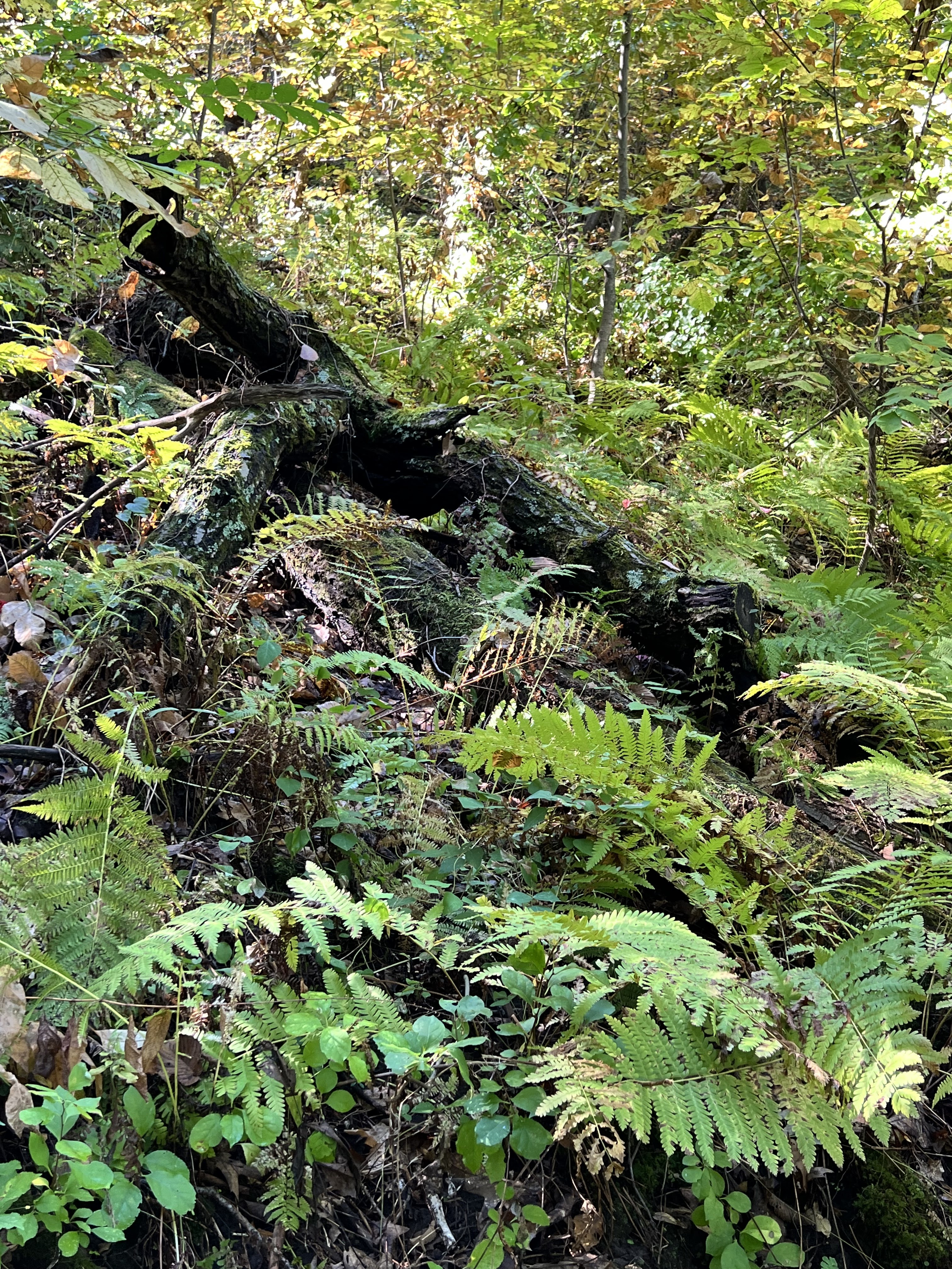 |
| Some of the MANY ferns on boB |
Keep your eyes peeled for a small trail to your right that takes you on a bridge over a small ravine. You will rejoin the main trail at (37). The forest here is less dense as you make your way to another series of small trail junctions. At Stinky's (35) keep heading straight and enjoy some easy switchbacks that bring you back to junction (8) up to Prairie Loop (9). Take a right and head back to the weatherball trailhead.
 |
| AllTrails map of the hike |
I recommend taking a map or app like AllTrails with you to keep you oriented. It's pretty easy to get on other trails since some of the trail markers are missing or not clear. I use my AllTrails to keep me going where I want to go.
I also want to give a shout-out to the trail builders and maintainers - historically from Human Powered Trails and currently from ORA - who do tremendous work on developing and keeping the trails in good shape. Hikers who wish to pitch in on work days are most welcome. Contact ORA to volunteer.
THE HIKE
Enjoy the lush, forested bluffsides of Hixon Forest in this series of rolling switchbacks and trails that wind around the sides of the forest's bluffs. There are multiple short trails that weave in and out throughout this complex of over 20 miles of trails for shared use and hiking. Some of the loop is challenging as you head up and down the bluffsides, but if one takes their time, these 2.5-2.7 trails that make up the loop will delight you. Stop here to see ORA/City of La Crosse maps of the multiple trail systems available for outdoorspeople.
The Location - N2788 County Road FA - La Crosse, WI 54601
From La Crosse, head up Bliss Road east towards Grandad's Bluff. Keep left at the Alpine Inn at the top and drive about 1/2 mile to Cty FA on your left. Turn right at the NOAA weather station by the radar "weatherball." There are three trailheads from this parking lot.(and one across the road that leads to the Prairie hikes.)
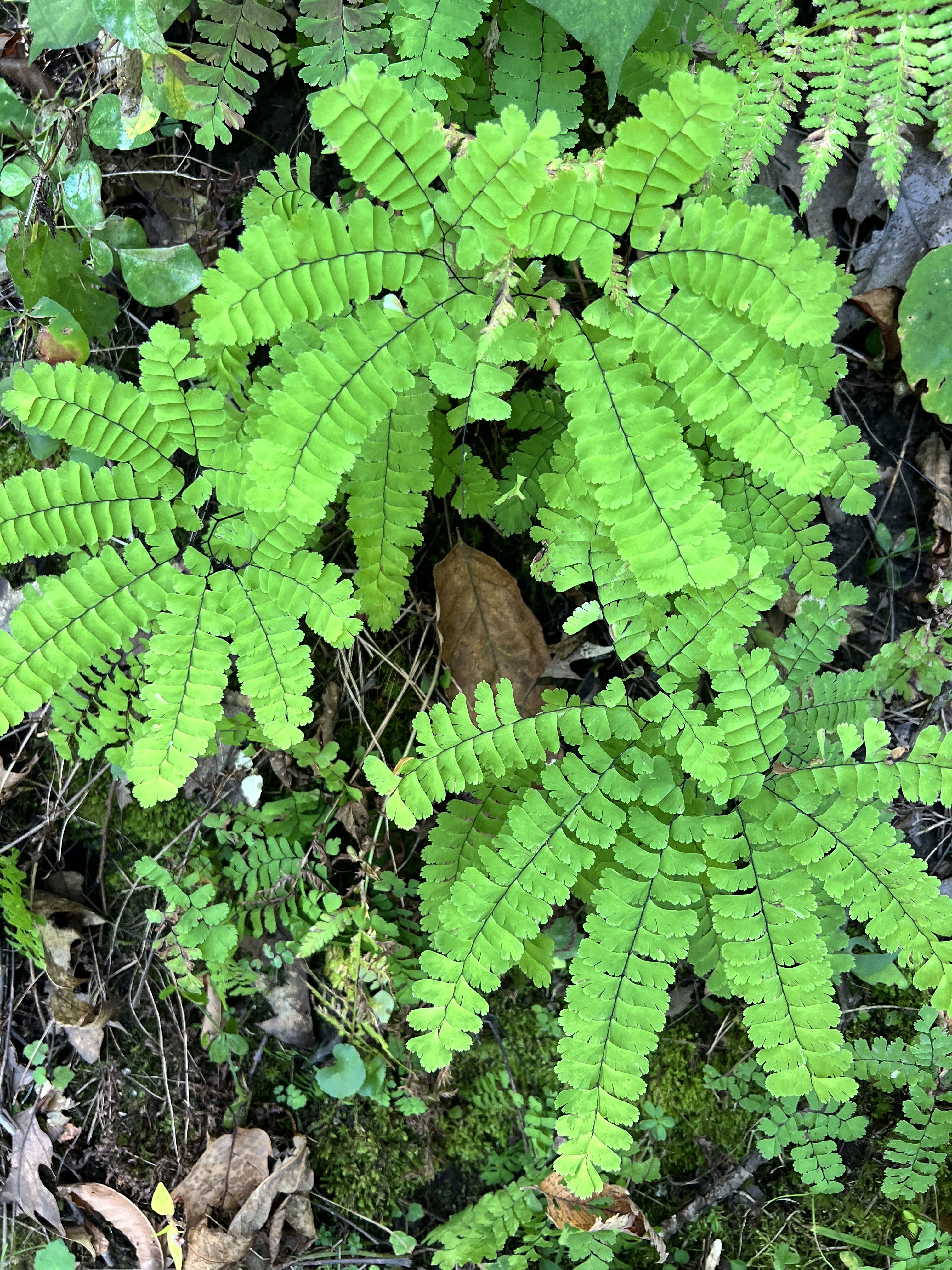 |
| Maidenhair ferns |
No comments:
Post a Comment