Monday, July 31, 2023

Where IS the Driftless?!?!

The "driftless" is a rare unglaciated area primarily located in west central and southwestern Wisconsin along the east side of the Mississippi River and just kissing northwestern Illinois. While both southeastern Minnesota and northeastern Iowa seem to share the same characteristics of the Driftless, they are actually not part of the unglaciated area and are outside the actual Driftless area.

From Wisconsin Geological and Natural History Survey. The Driftless Area. Educational Series 057.
Carson, E. C., Curry, B.B., Kerr, P.J. Lusardi, B.A.  University of WI Madison, 2023.

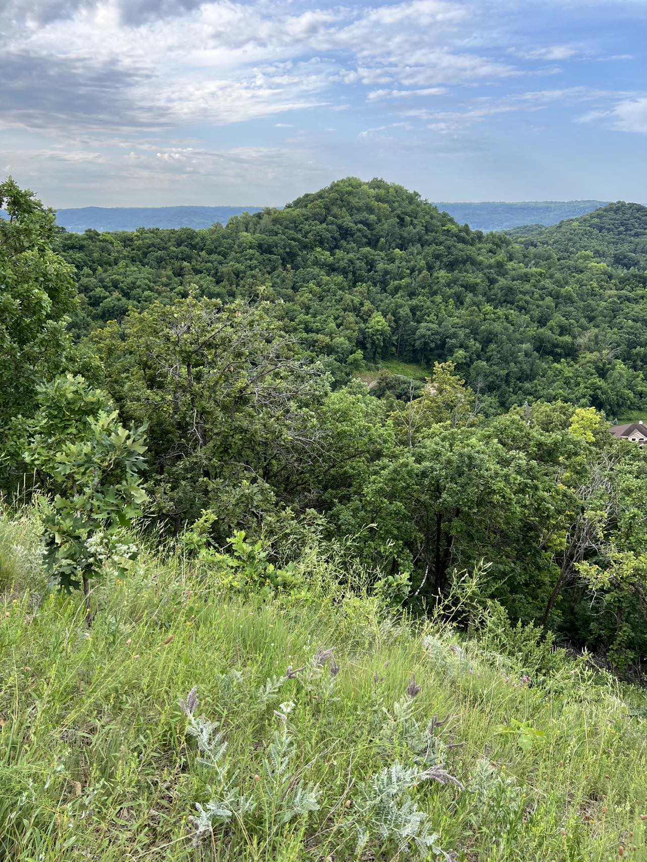
That can sometimes be hard for people to wrap their heads around. The area is a special gem of steep bluffs towering over the Mississippi River and a winding network of long valleys, bluffs and steep hills continuing outward from the river that create a magnificent landscape. It is a challenging environment in which to build, farm and recreate in. We all want to claim it as our own and have a fierce love of this landscape.

Alot of areas in southeastern Minnesota and northeastern Iowa across the Mississippi River sure look like the Driftless area to the west in Wisconsin and Illinois. There is a tendency - which even I have shared - to claim these nearby areas as part of the Driftless. But they actually experienced glaciation during the Pre-Illinoian Glaciation era (500K-2,600K ago). These areas don't display the lack of glacial sediment or "drift," as it was called in the mid-19th century, that the Driftless does.

A just-published pamphlet "that describes and outlines the boundary of the unglaciated Driftless area based on modern geologic evidence" breaks down the differences in easily understood language. Titled The Driftless Area: The Extent of unglaciated and simitar terrains in Wisconsin, Illinois, Iowa and Minnesota, and authored by members of each states' geological survey team, this brief pamphlet (2 pages of text and 2 pages of citations!) is a perfect short explanation of what is the Driftless area - and what isn't.

Because the Driftless area in Wisconsin and Illinois never experienced glaciers, it is truly "the Driftless."  The rugged landscape of bluffs, steep hillsides and coulees displays no evidence of glaciation. Rather the landscape was formed by rivers cutting down through the sediment and forming deep valleys. 

In surrounding areas in portions of southeastern Minnesota and northeastern Iowa, there is clear evidence that the Pre-Illionoian glaciation left glacial landforms and sediment.  However, because they are Mississippi River-adjacent, they were also steeply cut into by rivers and so they are topographically similar to the Driftless.

The four-state geological survey team suggest that it would be more accurate to say these areas display "Driftless-style topography." They are not truly Driftless.

From Wisconsin Geological and Natural History Survey. The Driftless Area. Educational Series 057.
Carson, E. C., Curry, B.B., Kerr, P.J. Lusardi, B.A.  University of WI Madison, 2023.

I'm perfectly good with being Driftless-adjacent in Minnesota. I'll be keeping the blog title as is but I'll be going back and adding a "Driftless area" tag to all blog posts of hikes that are truly in the Driftless. I also edited the blog's header slightly to reflect more accurately the distinction.

The more we know, the more we grow!  I love how scientific knowledge keeps evolving as research and knowledge is continually added to. It helps us to better know the world around us even as it refines - and sometimes - shakes up our understanding. 

Thursday, July 27, 2023

Hixon Forest Hickory Trail (WI) Amble/Hike

Ambles are what we in the Driftless Drifters* call hikes that are up to 2.5 miles long on flatter trails. They are perfect for people who like a slower pace, are recovering from illness or injury or just like to spend a little extra time on shorter trails enjoying nature. 

When we are planning Ambles, we like to make sure, in this hilly part of the Driftless, that hikers can enjoy some of the same fun as during our regular weekly long hikes. That means finding rim trails accessible at the top to get Amblers up to the good views; mixing in low prairie and wetlands hikes with forested hikes that often feature more rolling hills and small climbs in the lower portions of the bluffs.

Hixon Forest, a huge tract of forested bluffland in La Crosse WI park system, has a number of multi-use trails (bike/hike) and a few hike-only trails running throughout it's trail system. There is both an upper and lower trail system plus newer Gateway trails. All these trails combine to make a number of fun hikes possible in the hiking/biking trail system. This post focuses on just one possibility!

The Hickory Trail in lower Hixon is a great bluff trail to enjoy an Amble with a bit of elevation thrown in. It gives Amblers some rolling hills and a few elevation gains on the lower side of the bluff. This particular trail has plenty of fungi and spring ephemerals and nice shade for summer hiking.

To make this a loop trail, start the hike on the Bicentennial trail from the Lower Hixon parking area. This wide trail hugs the border next to a nearby golf course. This part of the trail is multi-use and features a a grass and dirt, wide old road bed. The trail gradually narrows and starts to slowly gain some elevation. Continue on until you hit the junction for the Hickory Trail heading to the left (the blue trail on the map).

Golden oyster mushrooms
Image - marge Loch-Wouters

This hike-only portion of the trail climbs up a little higher on the lower bluffside from here. Once up, you turn towards the left following the trail to enjoy a rolling walk along a narrow dirt path. The hardwood forest is a feast of wildflowers in the spring and a wonderful shady hike in summer. The hike brings you down again to the parking lot for a 2.6 mile amble.

If you want to add miles and challenge, once you've turned south on the Hickory Trail, you can look for the trail junction to the Savanna hike-only trail and head up to the top of the bluff where you can follow multi-use trails like Vista to a number of beautiful overlooks before heading down and back.  

THE HIKE

Hardwood forest, rolling hills and some great fungi possibilities, spring wildflowers and solid trails make this a fun Amble or family hike.  The 2.6 mile trail  has a total of 250 feet elevation gain, the majority of which are gradual. One long elevation climb of about 100 ft halfway through the hike to access the Hickory trail can be taken slowly by Amblers and the rest is all downhill to the trailhead. 

Location: 2600 Old Quarry Road

From the southside of La Crosse, take Losey Blvd south on Hwy 16. Just past the stoplight at La Crosse St, you go over a railroad overpass. Turn right almost immediately at Bluff Pass Rd, then another right at Milson Ct. That road ends at the large parking lot. There is a porta-potty available at the trailhead.

On the trail checking out the fungi
Image - Marge Loch-Wouters

* The Driftless Drifters is a member-led hiking club program sponsored through the La Crescent-Hokah Community Education Department of MN ISD 300. Begun in 2021, the group goes on weekly "under 5 mile" hikes around the Driftless area and weekly "Ambles - shorter hikes on flat surfaces for hikers looking for a slower pace. All hikes feature learning opportunities as they identify flora, fauna and fungi around the area. New members are welcome - the fee for the club is $14 /yr (July through June). Members have access to a weekly newsletter with hike locations. Contact Community Ed at 507 895-5150 to join.

Tuesday, July 25, 2023

What's in Your Pocket? Apps on the Trail

Or rather, what's in mine? 

In the grand tradition of EDC (every day carry), I want to share my favorite trail apps (at the moment).

While I'm a certified MN Master Naturalist volunteer, that doesn't mean I know ALL.THE.THINGS. It just means that I am willing to be a life-long learner in the natural world. Part of that learning goes on while I am on the trails during my various hiking adventures each week. As the seasons turn and various flora and fauna go through their life cycles and nesting cycles, my eyes and ears are attuned to what I'm seeing.

A typical scene when I am on my hikes
 id'ing stuff with my iphone
Image - Lloyd Lorenz
The challenge for me, as well as for many of us, is figuring out exactly what I am seeing and hearing. You would think I would know every natural thing I see (and have seen) by now. But I don't.  I'm STILL learning.

I always carry my trusty iphone, a favored piece of hiking EDC gear, to help me identify or verify what I see/hear. I never leave home without it!

Each season, I re-acquaint myself with what I encounter. The further into the season I go, the more I remember - although hiking companions hear me muttering identifications as I practice on every hike. And, for what I don't know, my apps and photos help me make the identification.

Here's what I use: 

iPhone 13 Pro Max photo app

This iphone version has a really excellent camera system and editing options that allow you to crop and straighten pictures. It also has a pretty good identification feature that gives you a first ID of flowers and fauna on the trails. I click on the bug or plant icon and I get a quick result that I can then add to the notes field.

This is a great "out-in-field" way to capture what flowers I am seeing while I am hiking. I also use it to record what I am seeing from trail-to-trail and day-to-day. 

Since I do weekly or bi-weekly phenology journal, it also helps me easily refer back to what I've been encountering.

I like to cross reference the ID with other apps I use once I'm back home to make sure the phone has the correct ID. Then I type the verified identification in the photo notes line. Pretty sweet!

Seek by iNaturalist


This app is a pretty huge delight on the trail. You just aim your camera at the plant, insect, fungi, amphibian, mammal, mollusk, reptile, bird, arachnid, fish (or other species). The app will often identify it on the spot. It then pops it into your observations which includes the date observed, its taxonomy, seasonal observations based on other users, range map of observations near year, similar plants and a short snippet from wikipedia (be sure to donate to them). If the identification isn't returned, you can forward the photo to the iNaturalist community for an ID. 

My only hesitations on this app is that the camera doesn't do great close-ups and it's hard to move photos from the iphone into this app. So it can be futzy on the trail. But for instant ID, it rocks.


PictureThis


I actually pay for this flower identification app for alot of its features. It is pretty darn good at flower identification accuracy. It is easily used to check IDs from my phone photos after the hike (or even on it, if I have cell service). I appreciate that feature because it two quick clicks from the photo to my confirmed id.

The identification includes a range of names for the flower including its scientific name. It has a FAQ area that often includes interesting tidbits that I can use when I am doing interpretive hike programs. They include characteristics of the plant, sometimes poems and symbolism, its taxonomy, range, where it is native, cultivated, considered invasive, garden use, and care guide.

It also saves my observations in "My Garden" so I can refer back when I am about to guide a hike. that I have scouted for flower and plant IDs. I can do my prep quickly and easily! All this info really helps me learn the plant better so the cost is worth it to me.

Merlin

Of course, you all yell! 

I have learned more bird song/call identification from this app than ever before. Created by the magical folks at Cornell Lab of Ornithology, this is most hikers' favorite app.

I really appreciate the sound ID, since birds often escape my eyeballs (except when I am with MN Master Naturalist friends and bird gurus Janet Malotky and Steve Dietz when all birds appear before my eye and binoculars). *

With Merlin, you can track not just what you are hearing, but locate the bird by following its sound to actually see them. Plus the app let's you hear recordings of birds to help you attune your hearing to the birds you are likely to hear at various times of the year.

AllTrails


Finally, you only have to hike with me for 4.5 minutes before you discover my sense of direction is absolutely nonsensical. If it's not a loop or an out-and-back, you may find me wandering 5 years later. It's why I heavily scout hikes I lead. I want to make sure no one follows me into the land of the lost!

For me the AllTrails app works swell. Like all crowd-sourced apps, you have to be on your toes - one person's hike doesn't always match another's or has weird names that don't really quite match the trails you are on. You can pre-download the map you want to use as the guide as long as you are aware you may want to hike that trail or trail system slightly differently.

On the good side though, you can just set the app to navigate and it will often display the trails you are on with names. While it sucks up battery while on the trail tracking your whereabouts, it has kept me on the straight and narrow every time I have used it.

I appreciate that it tracks mileage and elevation and that you can save your hike if you choose to. I use the app alot not just on the trail but for the blog to remind me of information. You can choose to review your hike after you are done or just look at the info and delete it.


What are YOUR go-to apps that help you stay on the trail, identify or make your hikes easier while you're hiking. Feel free to let me know in the comments or the next time you see me on the trails!  

*P.S. I really recommend going on one - or more - of their bird hikes at MN's Frontenac State Park. You will be gobsmacked and feel amazing at what you see thanks to their guiding.

Checking that ID
Image - Kris Lawson


Sunday, July 23, 2023

I Spy on the Trails - Week of July 9 and July 16, 2023

The past two weeks brought us some of the nicest hiking weather of the summer. It truly felt like June-in-July. There were a few rain showers so lawn mowers were again heard in the neighborhoods. But drought remains. Nights have been cooler than usual but we are bracing for the high temps that have plagued people elsewhere in the country for the upcoming week. We are thankful for better air quality these two weeks despite the continuing Canadian wildfires.

The rain has had a great effect of native prairie plants.  They are blooming everywhere and I have shifted my hiking destinations to get up to goat prairies and along flat sand prairies and planted pollinator gardens to enjoy the riot of color and re-discover rare natives. In other hikes, I have favored early mornings and shady hardwood forests.

Wildflowers

Spotted bee balm
Image - Marge Loch-Wuuters

  • Wild bergamot
  • Butterfly weed
  • Lead plant
  • Black-eyed Susan
  • Compass plant
  • Purple prairie clover
  • Prairie coneflower
  • Wild white indigo
  • Prairie sage
  • Little bluestem
  • Big bluestem
  • Tall cinquefoil
  • False boneset
  • Spotted bee balm
  • Thimbleweed
  • Prairie rose
  • Deptford pink 
  • Poppymallow

Poppymallow
Image Marge Loch-Wouters
  • Hairy puccoon
  • Oxeye daisy
  • Yarrow
  • Spiderwort
  • Hoary alyssum
  • White prairie clover
  • Purple prairie clover
  • Hoary vervain
  • Self-heal
  • Flowering spurge
  • Motherwort
  • Ferns (Maidenhair, Interrupted, Lady, Ostrich)
  • Coreopsis
  • Spotted beebalm
  • Tall anemone
  • Hawks-beard
  • Golden oyster mushrooms

  • Evening primrose
  • Canada lettuce
  • Goldenrod (pre-bloom)
  • Horseweed
  • Germander
  • Sweet Joe-Pye-weed
  • Grey-headed coneflower
  • Great mullein
  • White vervain
  • Tall hairy agrimony
  • Catnip
  • Evening primrose
  • Yellow salsify
  • Tickseed coreopsis

Wildlife (seen/heard/detected)
Monarch butterfly
Image Marge Loch-Wouters

  • Red-eyed vireo
  • Eastern Towhee
  • Spotted towhee
  • Eastern Pewee
  • Common yellowthroat
  • Field sparrow
  • Goldfinch
  • House wren
  • Clay-colored sparrow
  • Chipping sparrow
  • Arcadian flycatcher
  • Scarlet Tanager
  • Tufted titmouse
  • Nuthatch
  • Chickadee
  • Downy woodpecker
  • Wood thrush
  • Red-winged blackbird
  • Catbird
  • Yellow-bellied sapsucker
  • White-breasted nuthatch
  • Blue jay
  • Cedar waxwing
  • Buckeye butterfly
  • Short-horned grasshopper
Short-horned grasshopper
Image - Marge Loch-Wouters

What are YOU noticing on your hikes?

Two weeks of hikes: Upper Hixon Prairie Loop/Boulder Trail, La Crosse (WI), Lower Hixon Hickory Trail, La Crosse (WI), Holland Sand Prairie, Holmen WI, Wildwood Trail, Winona (MN); Savanna Oaks/Greens Coulee, Onalaska (WI);  Grand Crossing Trail, La Crosse River Marsh Trail, La Crosse WI; Kickapoo Caverns, Wauzeka WI.

Friday, July 21, 2023

Greens Coulee/Savanna Oaks (WI) Hike

A view from the north bluff
Image Marge Loch-Wouters
For those who love bluff hiking and steep slopes these two bluff gems are for you. Within this Onalaska city park are 82 acres protected by the Mississippi Valley Conservancy featuring remnant prairies and oak savannah that stretch through Greens Coulee. There are many trails to take between the two.


There are two bluffs in this city park with a trailhead running up to each bluff and connecting trails between them. The south bluff climbs to 1212 feet, one of the region's higher bluffs. The view on this bluff gives an expansive look at Onalaska, the Mississippi River and the distant MN bluffs. 


North bluff trailhead
Image - Marge-Loch-Wouters


Most of the main trails are wide old logging roads with narrower and often steeper side trails. You have to love  elevation gains on this hike. There is no switchbacking here; only gently curving trails that you head pretty much straight up or trot down! My AllTrails app indicated we had a nearly 700 ft elevation gain while hiking up and across between the two bluffs - and we started at the Cliffside Dr. trailhead at higher elevation! 

Remnant goat prairie
Image Marge Loch-Wouters

From the higher MVC Cliffside Dr trailhead at the North bluff, you can head through hardwood forests lush with ferns and along a ridgewalk to a beautiful remnant prairie full of wildflowers. Continuing on the trail ends at a stunning outlook of southern Onalaska and views of the MN bluffs.


North overlook
Image -Nola Larson

The second, lower Greens Coulee trailhead at Stonebridge starts in a bit of a wetlands and heads steeply up on a trail that brings you past a municipal water structure to a great outlook looking to the southeast. The trail continues around the south bluff to another outlook. Then head north and take various spur trails to the north bluff with views of west Onalaska.

Mushroom rock
Image - Marge Loch-Wouters

While there are also quarries and interesting rock formations along the trails, it is hard to see many of them except in winter. From the south bluff heading north, there is a great ridge walk up and through a remnant prairie that continues to one of the fun rock features (that you have to walk through a "buckthorn tunnel"" to get to). Halfway along this trail you come upon a huge dolomite mushroom rock. Winter is also a good time to seek this out when leaves are down (note microspikes are a must if you come north up the ridge trail to get there).

Descending with the
rope railing
Image - Greg Watson


If returning to the Stonebridge trailhead, hikers can choose the lower loop down from mushroom rock and take a shortcut down another steep spur that has a rope anchored down it as a railing to help you keep your footing. It is a fun feature and works for this very steep spur. You have to give those that maintain the trail credit for their work!


THE HIKE

If you like steep with the reward of views and goat prairie flowers, this is the bluff hike for you. There are enough trails and spurs to let you hike anywhere from 2-4 miles up and down between the two bluffs and scrambling up and down "shortcuts" and ridgewalks - plus around loops on logging trails and narrower spurs. The views are stellar; the rocks/quarries (when leaves are off) are fascinating and the goat and remnant prairies lush during the summer and fall months. 

Location: 

Stonebridge Ave parking area: From La Crosse, take Hwy 53 North to the Main St exit. At the bottom of the ramp, turn right at the light. At the roundabout turn onto Green Coulee Rd.* Go .6 mi to Clearwater Dr. Turn right and go .2 mi to Stonebridge Ave. Turn left and go .25 mi to the trailhead and a small parking lot on the right. 

MVC Clifford Dr parking area: Follow the directions above to *. Then go 1.25 mi and turn right on Clifford Dr. The trailhead is at the Clifford Dr cul-de-sac, and you may park there from May through October.

Image - Marge Loch-Wouters


Wednesday, July 19, 2023

Holland Sand Prairie (WI) Hike/Amble

Post-burn. Midsummer prairie flowers
Image - Marge Loch-Wouters

Midsummer is the time that native wildflowers shine on prairies as well as in planted pollinator gardens that bask in the strong sunlight. These native plants thrive in difficult conditions like the drought and hazy wildfire skies. They are especially beautiful when the prairies they grow in have been burned and renewed.

I always make sure my hikes in July and August feature ample opportunities to climb to goat prairies or stay lower on restored prairies alive with native flowers and their pollinators. The Mississippi Valley Conservancy's (MVC) Holland Sand Prairie hike is a jewel among these types of hikes.

Located just north of Holmen WI, this small state natural area (SNA), with about 1.75 miles of trail, lies on a river sand terrace that has been restored. This wind-blown sandy soil was deposited thousands of years ago.

Native plants
Image Marge Loch-Wouters
This soil is perfect for those who want their eyes bedazzled by a dizzying display of native flowers. The trail follows the boundary of the property with housing development and road along three sides. There is also a trail that bisects the property to bring you near to more flowers. But it is to the interior that one's attention is drawn. 

Over 150 species of native plants have been noted on this site. Species we saw in a recent walk included: wild bergamot, butterfly weed, lead plant, black-eyed Susan, purple prairie clover, prairie coneflower, white indigo, little bluestem, big bluestem, tall cinquefoil, false boneset, spotted beebalm, thimbleweed, prairie rose, deptford pink, poppymallow, hairy puccoon, oxeye daisy, yarrow, spiderwort, hoary alyssum, silver wormwood, white prairie clover, hoary vervain, flowering spurge. The prairie was alive with flowers.

Prairie after spring burn
Image Kris Lawson

The prairie was burned this spring - a fact you would never believe when looking at the lushness of the spreading plants. It really speaks to how prairies respond to fires to clear old growth to allow for seed to easily sprout. 

There are a couple of benches near the few trees on this site plus a stand of pine and another stand of mostly oaks. With little shade, this hike or gentle Amble (perfect for families and slow savoring), is wonderful in early morning and evening. It is also a site one can return to often from early spring pasque flower spotting to midsummer's profusion of blooms to fall asters.

The property is well maintained and managed by the MVC, town of Holland, the Prairie Enthusiasts and the Friends of Holland Sand Prairie

THE HIKE

A short under two mile hike around the boundary of this property and through the middle provides a stunning array of native wildflowers at any time of the growing season. Bring your flower apps to identify over 150 species of plants during the growing season. The rolling sand and mown grass trails have a bit of up-and-downing. Caution: badger holes and critter tunnels mean watch your step on the trails. Can be ticky even in dry conditions.

Location: W7781 County Road MH

From La Crosse, take Hwy 53 north to County Rd MH. Turn left onto McHugh Rd and follow it to the trailhead and parking lot on the left (just past Beaver Building Supply).

Tall cinquefoil
Image - Marge Loch-Wouters


Friday, July 14, 2023

Great River Bluff State Park (MN) Hike

Once known as O.L.Kipp State Park, the name was changed over 25 years ago to capitalize on this beautiful MN blufflands park.  The park contains two SNA's (State Natural Areas) - King and Queen's bluffs, which rise from near the banks of the Mississippi River to create expansive views of the river on many of the marquee trails.

This is my "next-door" State Park, just a couple miles from our home in La Crescent. It is amazing to have a State Park just 15 minutes away!

Goat prairie on the King's Bluff Trail

Different trails feature five overlooks around the park which, in and of itself, is a great reason to spend time on the nine miles of trails here. Many of these hikes provide ample shade from mixed oak/hickory forests, pine plantations and basswood/maple forests. Many of the hikes are along the blufftops and ridges which often have cooling breezes. Trails vary from dirt and gravel to grass.

Mississippi River in fall, south of East Overlook

This is an all-season-usage spectacular park. Great wildflowers in spring can be found along the East Overlook and campground trails. Summer calls for hiking along the King's Bluff trail where goat prairies are lush with pollinator fields. In fall, any trail is a spectacular riot of color and gives amazing views of MN and WI bluffs in full autumn regalia. Winter calls for cross country skis on groomed trails and snowshoes and microspikes off-trail throughout the park.

Oak/hickory forest


The trails vary from flatter, to gently rolling to rip-roaring up-and-down. The North and South Outlook near the picnic area trails are short and more accessible. A warren of trails between King and Queen's bluff and the picnic grounds are relatively easy and flat. There is also a nice set of easy prairie loops across the road from Kings bluff trail. 


Trails to Kerns Outlook from the campground are fairly easy.  East outlook on the south side of the park near the campground and interior trails from the south to the north can definitely be more challenging for changing elevation. 


This park is a real treasure for those who want views, flowers and a varying hiking experience. And if you do go, stop by La Crescent just down and the bluff and south and let's have some coffee and talk hiking!


THE HIKE

Plenty of well-maintained trails in this spectacular bluff park. King's Bluff trail (the first parking lot to the left after the registration area) is the MN State Parks "Hiking Club" trail and a must. Drive or hike to parking lots by the picnic area or over the narrow road to the campgrounds. Trails near the east Outlook are rolling and hilly. Many other trails are easy.

Location: 43605 Kipp Dr, Winona, MN 55987

From Hwy 90, take Nodine MN exit; turn east and follow Hwy 3 to O.L. Kipp Drive.


Tuesday, July 11, 2023

Hiking the Drifted - You CAN Go Back Home Again (WI)

A delightful grade-school reunion celebrating our 70th birthdays recently brought me back to Green Bay WI, my hometown. While I was there I had a chance to do a solid hike and a nostalgia hike in the drifted area of northeastern WI.

In the woods - Colburn Park

Colburn Park - a woodland gem city park

The nostalgic hike brought me back to Colburn Park. I grew up a block from this 50 acre city park. The park had recreational facilities including a playground, pool, the best sledding hill ever, soccer and baseball fields, tennis courts and a shelter which even to this day is staffed by "parkees" (summer interns who engage kids in activities and games). 


Great forestry work
creating the shady canopy

But to me, best of all, the largest portion of the park was a wild woods perfect for hide-outs, forts and adventures in the woods. It is the place that first got me excited about being outdoors. 

In the 60 years since I ran and played in the park, the wild part of the park that borders the neighborhoods has been much tamed. There is more open area. The old pine, oak and other hardwood trees, though far fewer than in their forested past, are well maintained and create an awesome canopy in the old woods. A few wild patches still  remain and there is a lovely nature walk between the main park and the pool.


A favorite childhood tree


It was fun walking the edge of the woods next the houses of the kids I played with. And many of those beautiful old trees which towered over me as a kid continue to grace the woods. If you need a lunch spot and a short amble in a gorgeously maintained woodland setting, this is a great stop.


Baird Creek Greenway - an urban forest hike

Friends living in the city recommended Baird Creek Greenway as a great hiking destination. The Greenway, established over 20 years ago by a Foundation of concerned citizens, saved a significant area surrounding a portion of Baird Creek that was slated for development. Over the years they have established a number of trails for walkers, hikers and bikers in the 600+ acre area in the midst of a huge development and just off the Hwy 43 freeway.

Baird Creek

I chose to hike the East Loop trail, a 3-mile, wildly fun up and down, rolling trail following the creek wetlands and prairie before heading up in elevation into white cedar swamp, upland forest, meadows and perched wetlands. The variety of habitat made every step an adventure of flora, fauna and fungi.

I picked the trailhead on Superior Rd right under the freeway. The noise from the road was significant and I was skeptical on how this hike would be. But before long I was well inside the greenway and the noise faded.

These hiking/mountain biking trails are narrow, one way trails that have to be a feast for mountain bikers. But they are also a celebration of nature for hikers. And they were great for a bluffhound like me with plenty of fun ups and turns for just over 200 feet in elevation gain in an area famous for its flatlands. There are many trail spurs so having my AllTrails app helped alot to keep me on the main trail. 


The hike starts on a damp wetland trail next the creek and then through prairies and meadows before climbing up into forested areas and cedar swampland on the way up. As the trail loops around you come near to neighborhoods and parks before plunging back down through woods to once more emerge at the trailhead near the freeway.

The park has shorter paved trails and a longer west loop that I plan to explore on another trip. It is truly a testament to how nature can be preserved amidst widespread development and urbanization.


THE HIKES

ColburnPark - 1380 9th St Green Bay WI.

A pleasant Amble through park and well-managed parkland (kudos to the city's Forestry Dept) with wild areas and, paved trail and mown grass. Almost dead flat it is a great example of a well-used and well-maintained large urban park. 

Baird Creek Parkway - multiple entry points, Green Bay WI

Multiple multi-use trails offer challenge as well as respite for hikers of all abilities and types, Longer, more challenging trails take hikers from creekside up hills into forests. The twists, turns, bridges and varying landscape make for great hikes just steps away from larger developed areas. Some road noise from a nearby freeway fades the further you go into the woods. The loop trails allow you to control the length of your hike. Because many of the trails are also mountain biking trails and hilly and winding, caution and awareness is important while hiking. I recommend an app like AllTrails on the rougher biking/hiking trails to keep you on track.


All photos - Marge Loch-Wouters


Sunday, July 9, 2023

I Spy on the Trails - Week of July 2, 2023

We had some hot days, some welcome rain and ended the week with perfect June weather - in July!! Air quality from the Canadian wildfires has definitely improved.  

Prairie flowers are in their splendor while the woodland flowers are dialed back due to drought. With some forest hiking on tap soon, I look forward to seeing what the woods have to say. Hope you have had lovely weather and been out on the trails!

Wildflowers

Underside of the bulblet fern

  • Rattlesnake master
  • Spiderwort
  • Compass plant
  • Cup plant
  • Wild bergamot
  • Motherwort
  • White wild indigo
  • Sulphur cinquefoil
  • Chicory
  • St. John's -wort
  • Skunk cabbage
  • Mullein
  • Virginia mountain mint
  • Emperor's nightshade
  • Butterfly milkweed
  • Leadplant
  • Big bluestem grass
  • New Jersey tea
  • Ferns (ostrich, bulblet, maidenhair, interrupted, sensitive)
  • Wood lily
  • Pointed-leaf tre-foil
  • Hemp dog-bane
  • Foxglove beardtongue
  • Yarrow
  • White sweetclover
  • Milkweed
  • Purple prairie clover
  • Harebell
  • Pale-spiked lobelia
  • False sunflower
  • Broadleaf enchanter's nightshade
  • Prairie coreopsis
  • Hop hornbeam (tree)
  • Black-eyed Susan
  • Indian hemp

Wildlife (seen/heard/detected)

American water frog

  • Leconte's haploa moth
  • Widow skimmer
  • Aurora damsel
  • Common wood-nymph
  • Ebony jewelwing
  • Yellow sulpher butterfly
  • Swallowtail butterfly
  • Monarch butterfly
  • Deer
  • American toad
  • American water frog
  • Indigo bunting
  • Common yellowthroat
  • House wren
  • House finch
  • Catbird
  • Rough-winged sparrow
  • Song sparrow
  • House sparrow
  • Swamp sparrow
  • Red-winged blackbird
  • Brown thrasher
  • Spotted towhee
  • Cedar waxwing
  • American redstart
  • Goldfinch
  • Cardinal
  • Robin
  • Red-eyed vireo
  • Great crested flycatcher
  • Eastern towhee
  • Eastern wood-pewee
  • Northern rough-winged swallow
  • Yellow warbler
  • Barred owl
  • Rose-breasted grosbeak

What are YOU noticing on your hikes?

This week's hikes: Butterfly Trails, Town of Shelby (WI); Wildwood Trails, Winona (MN); Apple Blossom Overlook Park, Winona Co (MN), Baird Creek Greenway, Green Bay WI; Colburn Park, Green Bay WI

All images- Marge Loch-Wouters

Doe on the Butterfly Trail


Big bluestem
Apple Blossom Overlook Park


Baird Creek Greenway


Wednesday, July 5, 2023

La Crosse River Conservancy Amble (WI)

Ambles are what we in the Driftless Drifters* call hikes that are up to 2.5 miles long on flatter trails. They are perfect for people who like a slower pace, are recovering from illness or injury or just like to spend time enjoying nature. 

The La Crosse River


The Mississippi Valley Conservancy has a number of interesting properties that they are preserving. One of their more unique ones is the La Crosse River Conservancy located in Onalaska WI. 

This wetlands stretches out from behind a hotel and hospital to the banks of the La Crosse River. The trailhead is located just to the west of Stoney Creek Inn. You climb down a short hill into the wetlands. From there the trails are mown but can be marshy (spring is not a good time to walk this trail if water is high).


One of the few large trees in the marshland

At the junction you can go the right or the left. Both options take you right along the a Crosse River. To the right on the west trail, there is a small area closed from April1 - August 1 during nesting season. When that area opens up, hikers can head to the natural bedrock mound and a bench on top before heading back. 

A view of the WI bluffs


Returning to the T, head to the right on the east trail along the river. until you reach the end of the property.


Sandhill crane


Be prepared for some dampness even in summer. The wetlands is alive with wildlife including birds like the sandhill crane and many types of herps. We were lucky to see a pair of cranes and a colt ampng the trails  on the day we were hiking. 

This is an awesome snowshowing destination for winter - the views of the WI bluffs and river are great and the on-trail or off-trail snowshowing is outstanding.


THE HIKE

This 2.5 mile out-and-back hike brings you up close and personal to a restored riparian marshland that features the unique birds, amphibians and reptiles of wetlands. The hike descends from the street level down to river level for an easy out-and-back 2 mile hike of flat mown trails. Because it is a marshy area, waterproof hiking shoes are a good idea. It is an outstanding winter snowshoe destination.

Location: 3060 S. Kinney Coulee Rd, Onalaska, WI 

From Losey Blvd in La Crosse, head north on Hwy 16 to S. Kinney Coulee Rd. Park along the road near Stoney Creek Inn or in the Gundersen Clinic ramp. The trailhead is west of Stoney Creek Inn.


Wet mowed trail

All photos - Marge Loch-Wouters

* The Driftless Drifters is a member-led hiking club program sponsored through the La Crescent-Hokah Community Education Department of MN ISD 300. Begun in 2021, the group goes on weekly "under 5 mile" hikes around the Driftless area and weekly "Ambles - shorter hikes on flat surfaces for hikers looking for a slower pace. All hikes feature learning opportunities as they identify flora, fauna and fungi around the area. New members are welcome - the fee for the club is $14 /yr (July through June). Members have access to a weekly newsletter with hike locations and tips as well as additional pop-up hikes. Contact Community Ed at 507 895-5150 to join.