Thursday, August 31, 2023

Canfield Big Spring Trail (MN) Hike

Last fall, I was intrigued to read in MN Conservation Volunteer magazine about three big spring sources to visit in southeastern MN. I had already visited two of the spring sources: Fountain Big Spring, on one of my MN Master Naturalist training field days; and Beaver Creek Big Spring in Beaver Creek Valley State Park. The third, Canfield Big Spring, looked like a great hike so a few friends and I scouted it out last fall. What a find! 

Drifters at the source of the spring
I recently shared the hike with the Driftless Drifters* hiking club in much warmer weather. Canfield Creek is located in Forestville/Mystery Caves State Park in southeastern MN near Preston. This 4 mile out-and-back hike features a mostly wide dirt and gravel road trail that winds along the south branch of the Root River and then follows Canfield Creek upstream to it's source. 

Bridge over the south branch of the Root River 
where Canfield Creek runs into it

You can begin your hike at the campground; at an "angler's parking lot," or a bit further near the group campground in non-summer times. Each trailhead leads you down a steep slope into the valley to a flat trail. Near the start, you cross a bridge spanning the Root River where the Canfield Creek joins it. From there you wind your way through hardwood forest.

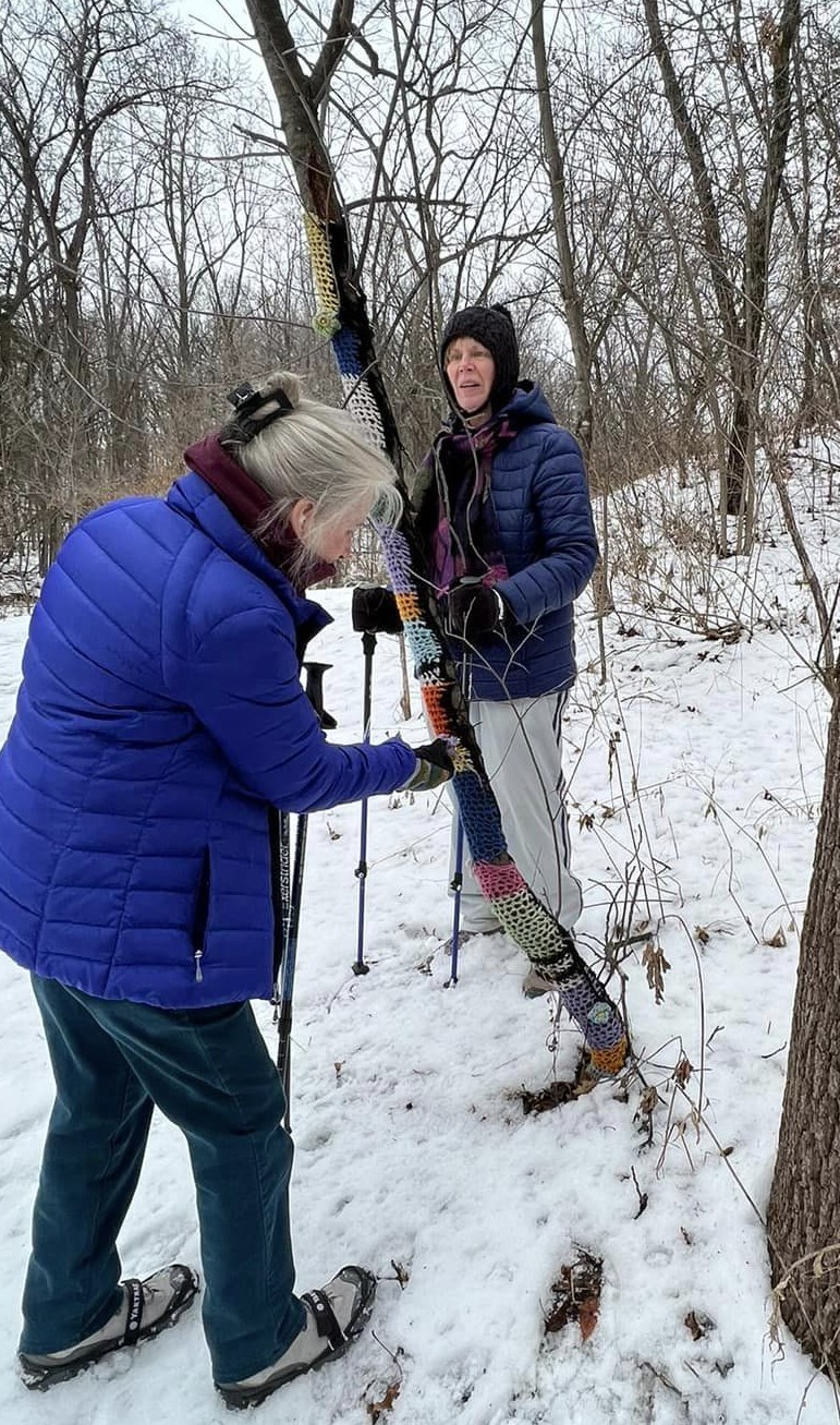
Boots and packs left behind
before the first crossing


About 1/4 mile from the source of the spring, a washed out bridge gives you your first opportunity to wade across the creek in the cold 47F water. It's nice to have sandals/watershoes for this short crossing. 

The water can be anywhere from ankle to knee deep depending on your height (or higher in spring or after big rains). This is your longest crossing. Stay in that footwear because you are getting close to the source. We left our packs and boots behind at this first crossing and hiked the rest of the way in our sandals/watershoes.


Looking inside the cave at the source
Image - Cyndy Reichgelt
In just a bit, you come to a hitching post (the trail is shared with horses) and across the way is the source of the creek. You can wade out to the small cave to take a closer look at the water streaming out of the limestone cave. Above the spring, the rock walls are covered in ferns and plants, suggesting the Hanging Gardens of Babylon.

The water can be deeper in this part of the creek but still walkable, especially if you have a steadying hiking stick. We lucked out (if you can call drought lucky) with low water levels. Even with shallower water, it's hard to stay long in the bracingly cold stream. I give big props to Drifter Cyndy Reichgelt who got right into the cave for this amazing view  of the cave's interior!


Big Spring source


The creek crossings and beautiful trail make this a fun adventure. Add on a tour of Mystery Cave (also a chilly 47F) like we did and you get two great examples of how the karst geology of this part of MN results in caves, sinkholes and multiple spring sources. 

I'll  share some of our Mystery Cave experiences as well as another cave adventure in the Driftless region - and information on karst geology - in my next blog post.


THE HIKE

After a steep descent into the valley, follow a flat 2 mile trail through hardwood forests along the Root River and Canfield Creek to the creek's source, Big Spring. You need to wade two creek crossings near the end (packing sandals.watershoes are an option) with cold 47F water that can be shin-to-knee-high in depth (depending on the season) to view the source - a small cave in the second creek. The trail is shared by horses so watch your step as you hike. Turn around and return to the trailhead for a 4 mile hike. 


47F water wading
Image - Nola Larson
Location
Forestville/Mystery Cave State Park, 21071 County 118, Preston, MN 55965

There are many roads leading to this park that is southwest of St. Charles on I-90. I have tried quite a few and like them all. You will be winding about but you WILL get to Forestville State Park. All are good and take you through beautiful farm areas and near many sinkholes as you drive closer (Fountain is the "sinkhole capitol of MN"). 


At the source
Image - Nola Larson

Images - Marge Loch-Wouters, unless otherwise noted

* The Driftless Drifters is a member-led hiking club program sponsored through the La Crescent-Hokah Community Education Department of MN ISD 300. Begun in 2021, the group goes on weekly "under 5 mile" hikes around the Driftless area and weekly "Ambles - shorter hikes on flat surfaces for hikers looking for a slower pace. All hikes feature learning opportunities as they identify flora, fauna and fungi around the area. New members are welcome - the fee for the club is $14 /yr (July through June). Members have access to a weekly newsletter with hike locations and information as well as additional pop-up hikes. Contact Community Ed at 507 895-5150 to join.


Tuesday, August 29, 2023

MacGilvray Seven Bridges (WI) Hike/Amble

Bridge #1
If you are interested in a floodplain forest/wetlands/sand prairie/oak savannah hike with historic bridges and a rich history, you can't beat this little gem that wanders through a large wildlife area rich in flora and fauna. 

I discovered this trail a few years ago after seeing a fascinating set of pictures of old bridges in the dining room at the the Trempeleau Hotel in Trempeleau WI. I was told there was a hiking trail there. When I hiked the trail, I was gobsmacked. This is a hiker/naturalist's delight.

Winter hike on the trail
Located in the Van Loon wildlife area, the  trail is an old wagon roadway across the wetlands, savannah and sand prairie floodplain forests of New Amsterdam. The road was originally built in the 1850s for a ferry service across the Black River at the road's end. Eventually, the ferry was replaced by a bridge and six other wooden bridges were built over the marshy backwaters. New steel bowstring bridges were installed at the beginning of the last century. Time and flooding eventually made even those bridges unusable. 

The WI DNR acquired the land and what was left of the bridges in the 1950s. In the late 1980s, Friends and supporters of the historic bridges formed a partnership with the DNR to save what was left of the old bowstring bridges, resulting in the trail we have today. It features five restored bridges plus a sixth that was brought in from Pierce County and restored. You can read more detailed histories of the bridges here and here.

Floodplain forest
But let's talk about the hike. A large parking lot with information kiosks are at the trailhead. You can either start your 3.6 mile out-and-back hike at the wooden stairs or take a road/trail down the hill to the right to hit the main trail. Once down the hill,  you are on a wide, dead-flat trail. 

The first three restored wood-plank bowspring bridges are in the first half mile of the trail. Along this portion of the trail you walk through a rich floodplain forest area. It's hard not to linger at each of this bridges so you can appreciate the ongoing work that the Friends of McGilvray do to keep these wood bridges in good shape.

Oak savannah

Continuing on, you come out of the forest into a huge oak savannah area with a large waterway running along the trail. Sand prairies with flowers abound as the trail begins to narrow and wind through wetland plants. You continue to cross bridges about every .4 miles along the way. You re-enter the floodplain forest just as you finish crossing the 5th bridge (the reclaimed, orange steel bridge transported from Pierce County). The 6th, and actually last, bridge on the trail is a crinkly one that underwent the most repair and restoration.


End of the trail
The seventh bridge that crossed the Black River at trail's end is long gone. It was removed in 1954. A bench at the river's edge let's you sit and imagine when it was once part of busy wagon and early car traffic as part of Hwy 93. But like all things built through wetlands, maintaining infrastructure amidst seasonal flooding is almost impossible.

What we're left with is a beautiful trail that features waterways, abundant bird and wildlife, grasses, prairie and forest wildflowers. And of course the lovingly restored and maintained bridges thanks to the DNR and Friends of McGilvray Road.

Bridge #4 in fall

THE HIKE

This 3.6 mile out-and-back flat trail follows an old wagon road to the edge of the Black River, crossing 6 historic restored steel bridges along the way. This is a great hike for any age/ability since you can turn back at any place along the trail. There is a slight descent at the beginning of the wide trail. The trail narrows about halfway through the hike until you reach it's end at the river's edge where a bench is placed. Hiking here in spring can be challenging because the wetland parts of the trail can be covered under running water. In summer, mosquitoes are fierce throughout the day (drought years like this one open up the summer trail use considerably). Fall and winter are great times to hike/snowshoe the trail. The Van Loon Wildlife Area is also open to hunting during many seasons. Staying on the trail and wearing blaze colors keeps hunters aware of you and helps keep you safe. 

The Location

From La Crosse, take Hwy 53 north. Turn right at Old Hwy 93 (the first right hand turn after the road narrows from 4-lane to 2-lane). Turn right at Amsterdam Prairie Rd. The trailhead is on your left about .6 miles down the road.


All images - Marge Loch-Wouters

Friday, August 25, 2023

Halfway Creek (WI) Urban Forest Amble/Hike


One of my favorite "urban forest" hikes is nearby in Holmen WI. I think of that type of hike as wildland that nestles in the middle of a community/communities. Housing, businesses and roadways surround the parklands or forest but when the trees are leafed out, trail users feel that they are much more remote. 

Wide graveled trails are great for any age
The last one I hiked was in a major metropolitan area. Halfway Creek Park is in the small community of Holmen WI with a population of 10,000. The trailhead is located just behind the village's government offices and a typical community park with picnic tables, play equipment and recently, tents for the annual Kornfest!

From the park, the wide trail of crushed rock heads down into the shaded forest. You get tantalizing peeks of Halfway Creek in between the trees. But it is only as you pass under the first road underpass along the trail (they are three overpasses on the hike) that the creek bursts into full view alongside the trail.  


Halfway Creek is a small, wild meanderer. It winds back and forth over almost the full 3.4 mile trail length. The trail features five sturdy steel bridges that cross the creek as you hike along the woods...sometimes next to the creek and sometimes further away. 


Yarn-bombed tree last winter!
The woods are full of wildflowers and plants. If you hike or snowshoe the trail in the winter it is surprising how many houses and buildings you see along the trail that are completely hidden during seasons when the leaves are lush. A treat along the way is the slim sapling that has been yarn-bombed. It's hard not to take a picture by it.

The trail ends after 3.4 miles at Hwy ZM near the village's waste water treatment plant where it runs into the Great River Road bike trail. On the other end of the trailhead where we began, you can also continue along the park until you meet up with Hollands Bluffs trailhead.


THE HIKE

Halfway Creek is 3.4 mile wide graveled trails that features fairly flat trails with hills only at the beginning and end. Hikers wind along the trail playing hide-and-seek with Halfway Creek as it meanders throughout most of the hike near the trail. Hikes can be tailored for any length (turning around at the third overpass gives you a perfect 2.5 mile Amble). This is a great place for snowshoeing off-trail in the winter. The forest floor is fairly clear in enough places to get you near the creek as you snowshoe. In summer and early fall, dense leaf cover makes you forget you are in the midst of a community. Three roadway overpasses do remind you - although, before you know it you are beyond them. A highlight of the hike are the five bridges crossing the winding creek.

The Location300 W. Roberts Street, Holmen, WI

From Hwy 53 heading north from Onalaska, take the first Holmen exit and head north. Turn right at the second set of stoplights. Take the third exit on the roundabout onto Main St. Turn left on Legion St or Roberts St and park in back of the library.

A lovely, tired old tree stump

                                                    All images - Marge Loch-Wouters


Tuesday, August 22, 2023

The Rim Trails of Beaver Creek Valley (MN) State Park

Bulblet ferns by sharp-lobed hepatica leaves
Beaver Creek Valley State Park (BCVSP) near Caledonia MN is one of the state parks I consider to be my "neighborhood" park. It is a quick 25 minute drive away from our home in La Crescent and a park we return to often. From it's trout stream trails to it's migratory spring warblers; from it's rim trails to it's spring ephemerals; from it's twisty-turny narrow footpaths up some of the hills and bluffs to it's watercress-kissed stream and it's source, this is a special gem that bears repeat visits.

Steep Rock Trail

Last spring I shared a post introducing you to this state park in southeastern MN. Today I want to focus on a couple of high trails up to and along the blufftops that surround the campgrounds in the narrow south valley: Steep Rock trail, Hole-in-the-Rock trail and West Rim trail. Doing a hike combining these three trails makes a wonderful 3.3 mile loop that takes you high above the park and that make up half of the MN State Parks Hiking Club trail (the other half is the flat Trout Run trail that takes you 3.3 miles along Beaver Creek on the north side of the park).

After parking in the first parking lot, cross the footbridge and immediately head left and UP onto the Steep Rock Trail. This narrow, twisting rocky/rooty dirt trail takes you along a 3/4 mile portion of west side of the rim. There are multiple lookouts and huge rock formations along the way that add interest as well as well developed hardwood forests. You will also see some amazing wildflowers (especially in spring) and some ferns that are more rare like bulblet and the tiny rock cap fern. Because of its steepness and a few spots where the trail is degraded, I would avoid this trail in damp or rainy weather. You end the trail down at the campground. This trail is closed during fall hunting season.

Overlook on the rim trails
Head to your right down the campground road for a bit to the West Rim trailhead. You climb up a wide old logging/farming road through hardwood forests and at one point next to an old farm field as you climb the west rim. There are a few high views through the trees but no overlooks to speak of on this slightly over a mile section of the trail. You enjoy a beautiful prairie or two before you head back down, cross a bridge near the bottom and come to stairs. If you take the stairs down, you are back at the campground road and can end your hike by following the road back to the parking lot. But if you take the stairs up...


Hole in the Rock trail cave

...you connect with the Hole-in the-Rock trail.  The beginning of this trail takes you up stairs and then a scramble up a steep rocky trail to an incredible overlook. You get a panoramic view of the west side of the narrow valley with a hint of civilization across the way. You have prairie to hike through as well on the top before coming to a marvelous cave you can climb right into. The1.2 mile trail continues ambling along a beautiful hardwood forest and more rock formations as it slowly brings you back down opposite the parking lot for 3.3 mile loop of all three trails.


THE HIKE

Three challenging to somewhat challenging trails take you up along the rim of the south valley of the park. Together these trails make a great 3.3 mile loop hike. Each one begins and ends at the campground road so as you hike the loop, you gain and lose about 500 feet of elevation a couple of times. Stunning overlooks of the park, beautiful hardwood forests, prairies and an abundance of rock formations including flat slabs perfect for a picnic and the scenic "hole-in-the-rock" cave, make this hike interesting. Hiking in spring means a profusion of wildflowers but I would avoid the narrower and steeper trails immediately after rain - they can be slick even in dry weather.

Location: 15954 County Rd 1, Caledonia, MN 55921

Follow Hwy 1 straight west from Caledonia into the park. These trails are accessed from the big main parking lot just past the ranger station.

A burr oak on Hole-in-the-Rock trail

All images - Marge Loch-Wouters


Sunday, August 20, 2023

I Spy on the Trails - Weeks of August 6 and and August 13, 2023

August always brings cooler nights, crickets, and childhood memories of the last desperate days before the start of school where we tried to jam as many adventures and as much mischief as we could. August also brings the Perseids, the annual fireworks show, that was particularly wonderful this year without the usual mosquitos. Knowing that this is the result of drought, though, instantly sobers me up.

We've had decent air quality over the past two weeks, welcome rain and relatively moderate temperatures. Summer isn't done with us yet as we look at temps back in the 90's coming up this next week. The leaves on the trees have lost their bright green hues and taken on a slight grayish tinge as fall approaches.

The elderberries are ripening, replacing the tasty blackcaps that are just about done for those who like making jams and wine.  Prairie flowers are showing off their the yellow flowers with the goldenrods coming into their glory along with black- and brown-eyed Susans. Rosehips are evident on prairie roses and pollinators continue nectaring at a mad pace.

The rain and slightly cooler night temps have brought fungi popping up again which makes woods walks more interesting. Ferns continue are evident everywhere in the woods..


Wildflowers

  • Wild bergamot
    Rock cap fern 

  • Goldenrod
  • Evening primrose
  • False sunflower
  • Brown-eyed Susan
  • White sagebrush
  • Grey-headed coneflower
  • Common tansy
  • White snakeroot
  • Joe-Pye weed
  • Tall blue lettuce
  • Jewelweed
  • Sharp-lobed hepatica (leaves only)
  • Jack-in-the pulpit, fruiting
  • Rock cap fern
  • Bulblet fern
  • Lady fern
  • Maidenhair fern
  • Crown-tipped coral mushroom
  • Old man of the woods mushroom
    Emerging ghost pipes


  • Golden oyster mushroom
  • White jelly fungus
  • White rot fungus
  • Scarlet elfcup fungi
  • Leadplant
  • Hoary vervain
  • Ghost pipe
  • Bottlebrush fern
  • False boneset
  • Big bluestem
  • Compass plant
  • Giant mullein
  • Goldenrod
  • Ground cherry
  • Cup plant
  • Rattlesnake master
  • Cardinal flower
  • Prairie blazing star
  • Smooth ironweed
  • Smooth agrimony
  • Oxeye daisy 
  • Great blue lobelia
  • Nodding onion
  • Stiff goldenrod
  • Hyssop
  • Sideoats grama

Wildlife 

  • Peck's skipper butterfly
    Tiger swallowtail butterfly leaving a cup plant


  • Tiger swallowtail butterfly
  • Monarch butterfly
  • Sulpher butterfly
  • North American toad
  • Eastern towhee
  • Eastern wood-pewee
  • Pileated woodpecker
  • Great horned owl
  • Barred owl
  • Indigo bunting
  • Black-capped chickadee
  • Northern cardinal
  • Bluejay
  • Red-eyed vireo
  • Yellow-throated vireo
  • Warbling vireo
  • American redstart
    Can you spy the indigo bunting?


  • Tufted titmouse
  • Indigo bunting
  • American robin
  • American goldfinch
  • White-breasted nuthatch
  • Least flycatcher
  • Acadian flycatcher
  • Pileated woodpecker
  • Sedge wren
  • Killdeer


What are YOU noticing on your hikes?

Two weeks of hikes: Hass Easter Road Trailhead Blufflands South, La Crosse WI; Upper Hixon Prairie Remnant Hike, La Crosse WI;  AppleBlossom Park, Winona Co. MN; Beaver Creek Valley State Park, Caledonia, MN; Riverside Park and Marsh Trail, La Crosse WI; McGilvray 7 Bridges, New Amsterdam WI; Halfway Creek Trail, Holmen, WI; Mathy Quarry, La Crosse WI

                                                 Above images - Marge Loch-Wouters

Hole-in-in-the-Rock cave, Beaver Creek Valley State Park
Image - Nola Larson


Friday, August 18, 2023

La Crosse Blufflands Easter Road (Hass) WI Trail

If you are looking for a good challenging climb and don't mind trails that have seen many boots, this Mississippi Valley Conservancy/city of La Crosse Park and Rec property is for you. On a fairly short 2.8 mile out-and-back hike, you gain over 400 feet of elevation. 

A typical rooty section of trail
Image - Marge Loch-Wouters

The trail is known as the Ridge Crest Trail in the AllTrails app and signage to that effect is now on the trail itself. The trail starts in the lower part of the bluff along a shaded, small stream. Once you cross over it on the bridge, you are on an old logging road that climbs rapidly towards the ridge top. This well-used trail has experienced quite a bit of erosion on it's old logging road sections as well as it's narrower ridge sections. The roots can make for rugged hiking. 


Rock formations on the ridge trail
Image - Marge Loch-Wouters

The rewards though! There is an outstanding narrow ridge walk  that just keeps climbing through the hardwood forests and some rocky features. You hike past 1-2 tough dolomite caps still topping the mostly sandstone formations. The sandy surface on parts of this trail speak to the primarily sandstone make-up of the bluff. 

There is plenty of birdsong here and hide-and-seek peeks of the city far below that tantalize you along the trail.  The trail up, and including most of the ridge walk, is well-shaded. 


Prairie reward at the top
Image - marge Loch-Wouters

Once at the top of the ridge, you walk through a meadow alive with pollinator flowers. Mid-summer and into fall are when the native flowers are a riot of color. You can see bee balm, sunflowers, golden Alexander, Queen Ann's Lace, compassflowers, coneflowers, asters and so much more depending on the season of your hike.

In the prairie, there is a bench overlooking the river and city. You have to peek through powerlines here to get that view and a view of Cliffwood bluff and the tiniest hint of Grandad's bluff to the north. 


In spring, winter, fall and early summer, there is a small, easily-accessed spur trail behind the bench that heads east-southeast through woods and a bit of prairie to another overlook featuring expansive views of a nearby valley, a Catholic shrine and and Mt La Crosse, a local ski hill. At the height of summer, this trail can be overgrown and tough to navigate (it helps to LOVE brambles and berry bushes if you want to grab this view) but the view is something else!

Waterford Valley Overlook
Image - Greg Watson

The woods walk has a great selection of wildflower ephemerals in spring and plenty of ferns and undergrowth in the summer, and the little creek at the beginning and end of the hike is always a special treat as well.

THE HIKE:

A 2.8 mile out-and-back trail takes you steeply up  on a shaded old logging trail to a narrow ridgetop trail along the top of the bluff. The trail continues on to a meadow prairie and overlook with a bench. The overlook to the city view is somewhat obstructed by tall powerline poles.  A smaller, nearby spur trail then takes you to another more spectacular outlook. This trail is not well-maintained and can be overgrown in the height of summer. The eroded, rooty trails and obstructed outlook at the top keep this off my top trails list. But if you are looking for a good aerobic work-out, this non-switchback, pretty-much-straight-shot-up may be for you!

The Location: Easter Road, La Crosse WI

From the intersection of Losey Blvd and Ward Ave, head east from the roundabout on Ward Ave to 33rd St. Turn right on 33rd and follow it south to Park Lane Dr. Turn left and go to Maple Drive. Turn right and go one block to Easter Rd and turn left. At the fork in the road, stay right and follow Easter Rd to a parking lot on the right about 1/4 mile up.

Tuesday, August 15, 2023

Upcoming Master Naturalist Training

One of the more life-changing events in my last few years was my certification as a MN Master Naturalist volunteer (MMNV) through the University of Minnesota Extension program. While I've always been an outdoors enthusiast, it gave me the tools to know more and be a more knowledgeable and committed volunteer in my community in preserving and enhancing natural areas.

Our April 2022 MMNV Cohort

There is a MN Master Naturalist volunteer training course coming up in September that focuses on two biomes along the Mississippi and Minnesota Rivers and the deciduous forests of the eastern regions of MN. I can't recommend it highly enough.

What's it all about?

For $295 (scholarships available), participants receive a textbook/materials and an intensive two-week training program consisting of 40 hours of classroom and field work plus completing a capstone project of their choice.  The instructors are the super-knowledgeable and super-enthusiastic Sara Holger and Jeremy Darst, park ranger/naturalists at Whitewater State Park (where the training takes place). Participants dive into the geology, history, ecology, hydrology, flora, fauna of the biomes and how to interpret nature for people. It's a fascinating and intense experience learning from instructors, field experts and doing volunteer work during that time. Plus you make alot of new friends in your cohort in the training that you can continue to learn from and connect with well after the training is done!

Weaver Dunes Field Trip

Once certified as a Master Naturalist volunteer, 40 hours of volunteer work annually are required to maintain one's certification. Those hours are easy to fulfill. You can do your volunteer work for parks, nature centers, your city via Park and Rec boards/commissions, interpretive hikes, trail maintenance; volunteering with Friends groups connected to large areas (conservancies, blufflands and prairie restoration); US and Fish and Wildlife sites and more. 10 of those hours can be be earned through training - workshops; webinars; presentations; guided interpretive hikes; field trips, etc. 

I mentioned life-changing at the beginning of the post. What did MMNV give me? First, a taste of all I didn't know. This past year has been full of opportunities to learn more on group hikes; from presentations and guided hikes and from solo hikes where I identify and re-identify all the flora, fauna and fungi I can find. On each hike I get a little better at spotting and identification. 

Checking out a sinkhole
on training field trip
It also gave me a chance to give back through volunteer work - planting trees and native wildflowers; leading interpretive hikes for kids and adults; assisting at parks and nature centers as a volunteer at events; serving on city boards/commissions preserving/enhancing natural resources and parks. Earning hours is a snap!

Everyone who is curious about the outdoors and everything in it is a naturalist whether they have taken the MMNV certification or not. For myself, the training fired me up even more and has placed me in learning situations with knowledgeable people that have advanced and deepened my understanding. 


There are still a few spots open in the upcoming course. I hope you consider this Sepember course or the spring course in April. You'll be glad you did.


Friday, August 11, 2023

Upper Hixon Forest (WI) Remnant Prairie Amble/Hike

Recently I participated in a hike guided by Friends of the Blufflands to see remnant prairies and the work that goes into maintaining them. 

It's easy to think, when we are at an amazing overlook or a healthy prairie is spread out before us or the view is unobstructed, that it just "comes that way." But far from it. In order to have prairies and overlooks, maintenance and care is required. On this hike we found out how. 

Hikers getting up close to the Zoerb prairie
Image - Marge Loch-Wouters


Jon and Mike explaining the hike plan
Image-Marge Loch-Wouters
Pat Wilson, president of the Friends, introduced Jon Rigden and Mike O'Brien, who led the group of interested hikers on a 2 mile hike to see three prairies along the rim of upper Hixon Forest in La Crosse. Two of the prairies, Zoerb and Lookout, are actively being restored and maintained by members of the Friends and other volunteers and one (Birch) has not been restored. The contrast could not have been more stark.


Birch Vista is overgrown without care
Image - Marge Loch-Wouters
The first prairie we came to was the Birch on the Birch trail spur off the Bicentennial Trail. This is a prairie remnant that hasn't been worked on in at least 5 years. The view is degraded and the prairie is difficult to see. It is obstructed by buckthorn, black locust, oriental bittersweet, sumac and other invasives. It is so overgrown that a bench that was there had to be moved back. It was an eye-opening example of what a prairie that is not being maintained looks like.


One of the restored prairies
Image - marge Loch-Wouters
We continued along Vista Trail to Zoerb and Lookout prairies which have been in the process of being restored and maintained by the Friends of the Blufflands for the last four years. Vive la difference!

Fire, consistent invasives control and much sweat equity have made the difference. These two prairies have been burned regularly which helps to suppress the woody invasives and clear the land so native prairie plant seeds can once more sprout up. This is an essential step in keeping all prairies healthy. Small refugia areas are left unburned within the burn site to preserve insect and small critter species so they can re-populate the burned areas as the plants grow back. 


Girdled trees in a buffer zone
Image - Marge Loch-Wouters


Invasives are cut and treated - often many times to reduce and eradicate them. Select tree species are carefully evaluated and removed to maintain light and restoration goals. This work is done on the prairie but also in buffer zones leading up to the prairie. This helps protect the prairie with a ring of healthy forest and savanna. Trees that have a tendency to send out clones when sawed down are carefully girdled and left to slowly die. This prevents them from sending out the clones. The crew returns once they are dead and removes them.


It's so easy to take for granted the prairies and views we see as we hike. A group like Friends of the Blufflands definitely makes that magic happen through informed decision making, careful research, applied scientific knowledge, hours and hours and hours of hard work and dedication. I invite everyone to support groups like this through donations or volunteering.

And, of course, after going on this guided hike that was so beautiful and informative, we Drifters did an Amble* there as soon as we could. It is a fantastic hike that is great for kids and adults. And for those that want more mileage, continuing on the Vista trail brings you to additional prairies along this "string of pearls" prairie hike. Read on for the hike deets.

THE HIKE

A rolling, hilly 2.3 mile loop-hike takes you to three remnant prairies and stunning vistas on top Hixon Forest. There is an elevation gain of slightly over 250 feat so taking it slow gets you to big rewards. Take the Bicentennial trail left at the trailhead until you come to Birch Loop and the first overgrown vista. Finish the Birch loop and turn left onto the Vista trail with spurs to Zoerb and Lookout vistas, which are beautifully maintained prairie remnants. From the Lookout vista spur, retrace your steps back to Vista trail, turn right and head back where you hiked in until the trail branches left away from Birch and back up to the trailhead via Vista. For more miles, after the Lookout spur, turn left on Vista and wind your way to additional prairies on that hike and at Miller Bluff.

The Location: N2788 County Rd FA, La Crosse WI

From La Crosse Main St, head up Bliss Rd, veer left past the Alpine Inn to Cty Rd FA. Turn left on FA and then right at the parking lot for the NOAA weather station. Once parked, cross FA to the west and walk down a short hill to the trailhead and map. Note: at the corner of F and FA there is an old field full of planted oak trees as a reforestation project of Friends of the Blufflands

*Ambles are part of the Driftless Drifters hiking club. The hikes are up to 2.5 miles long on flatter trails, perfect for people who like a slower pace, are recovering from illness or injury or just like to spend a little extra time on shorter trails enjoying nature. The Driftless Drifters is a member-led hiking club program sponsored through the La Crescent-Hokah Community Education Department of MN ISD 300. Begun in 2021, the group goes on weekly "under 5 mile" hikes around the Driftless area and weekly "Ambles.". All hikes feature learning opportunities as they identify flora, fauna and fungi around the area. New members are welcome - the fee for the club is $14 /yr (July through June). Members have access to a weekly newsletter with hike locations. Contact Community Ed at 507 895-5150 to join.


Tuesday, August 8, 2023

Hixon Forest Oak Trail (WI) Hike - A Perfect "Hot" Hike

Hixon's Oak Trail


Hixon Forest is a La Crosse blufflands park that offers multiple trails for any skill level and age. The majority of the trails are multi/use (hike/bike/run). 

During really hot weather when I still want to hit the trails, one go-to for me is Hixon's Oak trail on the north side of Grandad's Bluff. Located partway up the bluff, the rolling, windy trail in the woods is shady and protected from the sun by trees and the bluffside.  


A lovely old stump

The trail is a little under 3 miles out-and-back but it is easy to add additional miles. At it's end, you run into a junction where multiple trails branch off that can lead you into the larger trail system that can take you all the way up to the blufftop. No guarantees of coolness once you start climbing though!


This trail is great in any season too. Spring wildflowers, fall colors, and protection from winter winds make it accessible and interesting anytime. The winding trail makes this an interesting hike. Bridges along the way over ravines built by dedicated trail maintenance volunteers keep you rolling forward. Some of the trail is below the main access road to Grandad's Bluff so traffic is present.

The notable rock formation


While there are fewer views available along the trail since it is on the side of the bluff, you can often glimpse the bluff tops across the way and their prairies. The dirt and rock trail climbs to one rock formation before quickly heading down to the merging trails near the end.


Images - Marge Loch-Wouters

THE HIKE

This 3 mile out-and-back hike along a bluffside features dirt and rock path along a rolling, twisty trail. Total elevation gain is about 433 feet. Hardwood forests provide great shade and ferns and fungi along the way provide interest. Glimpses of bluffs and prairies as well as a rock formation and bridges can be found along the trail. Spring wildflowers and longer views to the bluff in winter also provide interest in this protected bluffside hike.

Location: 

From La Crosse, follow Main St east until it turns left and becomes Bliss Road. Drive straight and go into parking lot before making the first curve to the right. 


Sunday, August 6, 2023

I Spy on the Trails - Weeks of July 23 and July 31, 2023

The weather has been a real mix over the past two weeks. There have been some lovely, low-humidity June-like days mixed in with some storms, rain and some blistering hot and humid days. With little rain, the MN DNR declared on Friday August 4 that our area is in severe drought.

The air quality has been good these past two weeks. Any haze we see is mostly due to high dew points. 

I've been doing some great early morning hikes to beat the heat. On the trails by 7:30 and off before 10:00am. There are fewer varieties of songbirds calling as many species are finishing their nesting seasons. 

Prairies remain glorious while woods-hikes are less showy. The ferns and fungi are having their day though and the lush canopy despite dry times offers great hikes in the shade in the hot days of July and early August.

This week I am also sharing the Frontenac (MN) State Park Association Newsletter that perfectly captures the sense of August in nature. Lots to learn and great upcoming events as well!

Wildflowers

Deptford pink
Image- Marge Loch-Wouters

  • Spotted bee balm
  • Whorled milkweed
  • Wild bergamot
  • Tall cinquefoil
  • Partridge pea
  • Poppymallow
  • Deptford pink
  • Evening primrose
  • Flowering spurge
  • Black-eyed Susan
  • Brown-eyed Susan
  • Leadplant
  • Common milkweed
  • Hoary alyssum
  • Thimbleweed
  • Motherwort
  • Hoary vervain
  • Purple prairie clover
  • Little bluestem grass
  • Big bluestem grass
  • Yarrow
  • Spiderwort
  • Silver wormwood
  • Hairy hawkweed
  • White sage
  • Goldenrod (unbloomed)
  • Mullein
  • Narrowleaf hawksbeard
  • Grey-headed coneflower
  • Germander
  • Ferns (Interrupted, maidenhair, bulblet, sensitive, lady) 
    Blooming false boneset - these plants
    can have 15 ft long roots
    Image - Marge Loch-Wouters

  • Fringed loosestrife
  • Self-heal
  • Blanket flower
  • Indian pipe
  • Canada rye grass
  • Side oats gamma
  • Prairie blazing star
  • False boneset
  • Goldenrod
  • Culver's root
  • Leafcup
  • Bottlebrush grass
  • Prickly lettuce
  • White snakeroot
  • Jump seed
  • False sunflower
  • Sweet Joe Pye weed
  • Goldenrod

Wildlife (seen/heard/detected)
Brown-belted bumblebee
Image - Marge Loch-Wouters

  • Field sparrow
  • Indigo bunting
  • Black-capped chickadee
  • Red-eyed vireo
  • Small copper butterfly
  • Brown-belted bumblebee
  • Giant swallowtail butterfly
  • Black swallowtail butterfly
  • Monarch butterfly
  • Common yellow throat
  • Meadowlark
  • Pileated woodpecker
  • Easter towhee
  • Eastern wood peewee
  • Catbird
  • White-breasted nuthatch
  • Song sparrow
  • American goldfinch
  • Tufted titmouse
  • Red-bellied woodpecker
  • Northern cardinal
  • House sparrow
  • Song sparrow
  • Blue jay
  • Red-winged blackbird
  • Wood thrush
  • American crow

What are YOU noticing on your hikes?