 |
| Image -Mike Bonner |
As you head up and down the trail (320 feet of elevation gain) you come to a fork. Take the right hand way and continue upwards amidst lush growth.
On my first May visit, we passed enormous Jack-in-the-Pulpits all along the bluffsides. To the right you can see one Marge-thigh-high Jack.
As the spring has given way to summer, the trail has gotten a bit more overgrown so keep your eye out as the trail heads steeply up to the right. Once you climb that short steep section, the rest of the trail to the top is a snap.
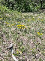
Keep going and you will emerge into a lovely wild prairie remnant at the top. Each time I have been there over the past two months I have spotted a rare native plant or two along with prolific varieties of more familiar prairie natives.
Once at the prairie, there are options to continue to your right or left and continue hiking to the borders of the park by climbing a bit more. We added another mile + and additional elevation gain exploring these these two other blufftop and bluffside trails.
The right hand trail follows a steep old logging trail down through interesting rocks and growth. You dead end at the park's border. In early summer, we chose to bushwhack back (bushwhack seen at the top of the map) in a fairly clear understory to the main trail rather than climb our way back to the prairie. The left hand trail continues on a very little used section on top the bluff that is a pleasant flat trail before it too runs into the park's border. On that section, we backtracked to the prairie to finish our hike.
Once back on the prairie, if just doing the 1.5 mile loop up to the prairie and back, head down towards the chimney rock and turned right to follow a trail that hugs the opposite bluffside on the way down. There is a large downed tree trunk to go over and then a pleasant rolling trip down to rejoin the main trail.
THE HIKEThis city bluff park has a main trail loop of about 1.5 miles and 320 feet elevation gain that you can hike to a lovely wild blufftop remnant prairie. The main loop to the prairie, past a towering chimney rock formation and back, is about an hour if you don't stop to admire the many lush plants and fungi. Exploring the trails at the bluff top adds an extra hour of poking around in the woods and on an old logging trail on the bluffside. In terms of difficulty, there are many steep spots and the trails can be damp and a bit greasy, so a hiking stick can be a plus.
 |
| Bushwhacking revealed a treasure trove! Image - Nola Larson |
All images, unless noted -Marge Loch-Wouters
Looking for more area hikes? Please stop by the web version of the blog and under the "Labels" tab on the right hand side of the blog, click on "find-a-hike". There are over 75 hike descriptions and lists of hikes to try!


No comments:
Post a Comment