Wednesday, February 28, 2024

I Spy on the Trails - February 2024

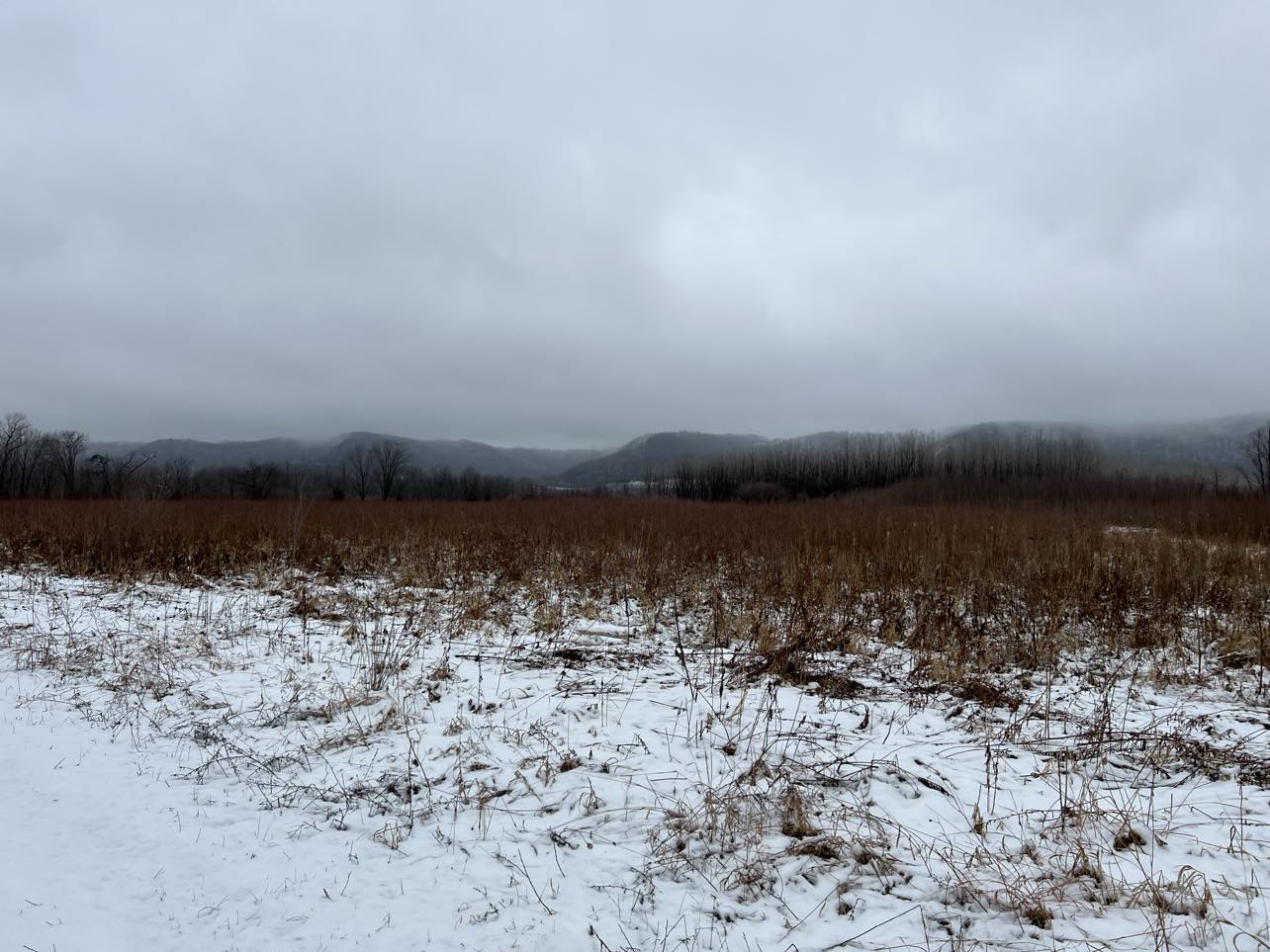
Root River WMA wetlands
February. Hmmm, what can I say? It was part and parcel of our ongoing "lost winter." I have been following meteorologist Paul Douglas' updates and musings on this El Nino-powered winter and that has certainly given me pause. 

Except for three days in the teens/20s, we experienced an entire month of daytime temperatures above freezing. Our two snows were pretty much melted by the following day. This extraordinary run of warm weather hit 40s and 50s throughout most days this month. Weirdly weird.

I will say more sunny days were very welcome. Much of January and some of February were foggy and hazy because of the warmer weather.


La Crosse River Marsh wetlands
Spring migration of Canada geese, sandhill cranes and tundra and trumpeter swans has begun. Robins are coming back and goldfinches as well. This is slightly earlier than I've seen other years. 

On the hiking front, the big quest for me was finding hike-able firm trails. Some trails have been mushy so my usual February hiking/snowshoeing haunts weren't available. We are also in a severe drought in this area of the state so that did open up other possibilities in this very early freeze/thaw cycle. Some of the wetland hikes that are too wet to hike are actually quite solid because of the low water and lack of snow.


Great River Bluffs State Park MN


One strategy for hikes  - I did alot of early morning hiking when trails were firmed up after cold nights. It prevented leaving muddy tracks and preserved the trails. I also keep a list of go-to outdoor trails just for freeze/thaw cycle weather (you'll see some of them below). Most feature old gravel roadbed trails which remain firm in this iffy warm weather. Last month's post has additional ideas for good freeze/thaw hiking destinations in the Driftless.

I returned a number of times to the hikes below this month and found something new and wonderful each time.


Trempealeau Wildlife Refuge
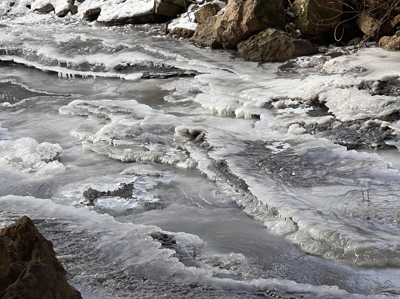
Despite the odd weather, there were plenty of beautiful things to see on the trails - whether trumpeter swans and eagles; ice sculptured reeds and snow covered prairie plants; foggy bluffs or hazy vistas

Wildlife (seen, heard, detected)
  • Blue jays
  • Robins
  • Canada geese
  • Goldfinches
  • Tundra swans
  • Trumpeter swans
  • Sandhill cranes
  • Hairy woodpecker
  • Downy woodpecker
  • Great horned owl

I also saw spiders and beetles near the end of the month!

Burr oaks, Great River Bluffs State Park

What are YOU noticing on your hikes?

Month of hikes:
Root River WMA, Hokah MN(3); La Crosse River Marsh, La Crosse WI (2); Necedah Wildlife Refuge, Necedah WI; Lytle’s Landing, Brice Prairie WI; King's Bluff Trail, Great River Bluffs State Park, Nodine, MN; Riverside Park, La Crosse WI (2); Wagon Wheel Trail, La Crescent MN (2); Lower Diversion Dike Trail, Trempealeau Wildlife Refuge, Trempealeau WI; Kiep's Landing Dike Trail, Trempealeau WI; (2) Reno Quarry, Reno WI; Reno Spillway, Reno MN; Oxbow Dike trail, Trempealeau Wildlife Refuge, Trempealeau WI (2)


A busy beaver at Trempealeau Wildlife Refuge

The "I Spy on the Trails" column is a phenology (the study of seasonal changes in plants and animals) journal to chronicle year-round the weather, plant life and wildlife I observe while hiking. It is very useful in helping me compare observations from year-to-year. The column is published monthly from September through April and then twice-a-month from May through August when warm weather brings the natural world back to vibrant life.  

All images - Marge Loch-Wouters

Saturday, February 24, 2024

Trempealeau Wildlife Refuge (WI) - Two of the Dike Trails Hikes

On Kiep's Landing Trail
If you're looking for an incredible hike during the sloppy spring freeze/thaw cycle, you can't go wrong exploring the dike trails at the Trempealeau Wildlife Refuge between Trempealeau WI and Winona MN. I'm focusing in this post on two of the easternmost trails: Kiep's Landing Dike and Lower Diversion Dike.

A birder's paradise, these flat, accessible trails feature firm surfaces (they are old roads) and bring you right down to the water and beautiful views of Trempealeau Mountain and the MN and WI bluffs. During migration seasons, the floodplain forests are a riot of songbird action and the backwaters are full of waterfowl action. Eagles are found in abundance.

Both trailheads s are near each other less than a 1/2 mile from the Visitor's Center. There are parking lots by both trailheads. Each hike is an out-and-back hike.

Lower Division woods
Lower Diversion Dike begins with a walk among rolling woods, many of which are located on old sand dunes. During migration, the raucous calls of Canada geese, trumpeter and tundra swans and other waterfowl can be heard through the trees. After about a mile or so, you leave the woods and hike out onto the dike where you have great views of the backwaters of the Mississippi and Trempealeau Mountain next to Perrot Park in WI. The 2 mile (one way) hike ends at a gate near Trempealeau Mountain. There a a number of benches along the trail on this longer hike.


Trumpeter swans and Canada geese along Kiep's

Kiep's Landing Dike is where you can see birds and waterfowl at a closer range (but bring your binoculars for the best viewing). You start out from the boat landing, and head down the dike road. The first half-mile is through the woods and this is where you can hear and glimpse numerous birds in the water and woods. There is a bench halfway down this 1 mile trail. Continue on with the backwaters on each side of you and catch glimpses of eagles, beaver activity and spectacular bluff and Trempealeau Mountain views. 

THE HIKES
Beaver not only taking down tree but trimming it!
While each of these trails begs to be walked in any season, spring migration and firm footing as the snows melt make these two trails perfect to hike in February-May. Kiep's Landing is a 2.5 mile out-and-back hike. Lower Diversion Dive is a 4 mile out-and-back hike. The flat trails make them great for any age/condition and benches along the way let you rest or sit to contemplate or quietly observe the abundant wildlife. The floodplain forest, the Mississippi backwaters and stunning bluff views are awesome in any season though so keep these trails on your year-round list.

A view of Trempealeau Mountain

The Location
W228488 Refuge Road, Trempealeau WI
The Refuge lies just south of WI Hwy 35/54 between Centerville and the bridge to Winona. Turn south on West Prairie Rd and continue until you see the Trempealeau Wildlife sign where you turn right on Refuge Rd. Proceed along that road until you see a sign for a left turn to Kiep's Landing (or continue straight to the Visitor's Center and check out their information inside).

Additional posts describing Trempealeau Wildlife Refuge trails:

All images - Marge Loch-Wouters

Looking for more area hikes? Please stop by the web version of the blog and under the "Labels" tab on the right hand side of the blog, click on "find-a-hike". There are over 75 hike descriptions and lists of hikes to try!

Wednesday, February 21, 2024

Let's Get Hiking - and Learning! March 2024


Will March come in like a lion or a lamb? I am thinking lamb after our mild February. Below are fun learning opportunities to take advantage of as we slip into our more official spring.

Click on the titles or brown-colored links to find more detailed info.

Festival of Owls           
Houston MN
March 1-3                         all day
Live owl programs, kids crafts, owl prowls, speakers and other activities plus much more at this event International Owl Center in Houston MN. Sponsor: International Owl Center, Houston MN

Brice Prairie WI
March 2                noon - 4:00pm
Please join us to celebrate this milestone anniversary and honor Leopold’s enduring legacy! Leopold’s work will be celebrated in a series of FREE events in the La Crosse area as part of an annual state-wide celebration. Here’s what’s happening at the Refuge! Registration is not required. The Visitor Center doors will open at 11:45 p.m.
12:00 p.m. presentation: “Fins, feathers and firebrands: 100 years of conservation on the Upper Mississippi River Refuge.” Come learn about the passionate and vocal visionaries who influenced the Refuge’s creation, major events which shaped its physical and social landscape, and how you can help shape the next 100 years to come!
1:00 p.m. presentation: “Prairie gardening 101: how to add beauty to your yard or public space” by Dr. Melinda Knutson. Join retired US Fish and Wildlife Service regional wildlife biologist and conservation planner, Dr. Melinda Knutson, to discover why we care about prairies, how you can get involved in local conservation efforts, and tips and tricks for adding native prairie and savanna plants to your garden at home!
2:00 p.m. Guided winter plant walk: Join a Refuge Ranger for a short walk on the prairie to learn about common native prairie plants in their winter condition! We’ll walk about a 1/2 mile along an unplowed paved trail. Please come dressed in warm layers for the weather!
12:00 p.m. – 4:00 p.m. Native plant giveaway and native seed planting: One of the best ways we can help wildlife of all kinds is to grow native plants! Stop by anytime between noon and 2:30 p.m. to pick up a wild bergamot or butterfly milkweed starter plant to take home. From 2:30 p.m. – 4:00 p.m., we’ll have soil, pots, and seeds available for visitors who’d like to drop in to plant their own seed to take home. These recently planted seeds can be transplanted into a backyard garden or larger plant pot later in the spring.  Thanks to Mississippi Valley Conservancy and the Friends of the Refuge – Mississippi River Pools 7 & 8 for providing the seeds and planters! PLANTS WILL BE AVAILABLE WHILE SUPPLIES LAST, please limit 2 plants per person. 
Sponsor: Upper Mississippi River National Wildlife & Fish Refuge.

Maple Syrup Making for the Whole Family
Whitewater State Park, 
Saturday March 2     10-11:30 am or 1-2:30 pm 

Celebrate spring in Whitewater State Park's sugar bush! This activity will introduce the long history of maple syrup and sugar making, as well as the equipment and procedures used. Participants will tap trees, gather and boil sap and best of all taste pure maple syrup! Meet at the the Whitewater Valley Visitor Center. Reservations are required. To sign up, email Jeremy.Darst@state.mn.us or call 507-312-2301. Sponsor: Whiewater State Park

Bald Eagle Day              
Ferryville WI
Saturday March 2        9:30am - 3pm
Two programs with live birds, nest building, crafts, hooting contest. Ferryville Village Hall, Free. Sponsor: Village of Ferryville (WI)


Visit from Will Dilg               
Lansing IA        
Saturday March 9                       2-4:00 pm
Celebrate the Upper Mississippi Wildlife and Fish Refuge's 100th Anniversary with this event . Steven Marking plays Will Dilg, founding president of the Izaak Walton League and the driving force behind the formation of the Upper Mississippi National Wildlife Refuge 100 years ago. Our mighty Mississippi-a magical journey of song, storytelling and visual imagery celebrating America’s greatest river with Steven Marking an acclaimed baritone, Resident Entertainer for American Cruise Lines, and an inspiring champion for the Mississippi River. Trailer Here. In this 45 minute show Steven Marking shows what one inspired man accomplished and teaches us that we must all be actively involved in protecting and managing the great outdoors. Sponsor: Big River Magazine, Friends of Pool 9 and TJ Hunters Banquet Hall (Lansing IA)

Maple Syrup Making for the Whole Family
Whitewater State Park, 
Saturday March 9     10-11:30 am or 1-2:30 pm 

Celebrate spring in Whitewater State Park's sugar bush! This activity will introduce the long history of maple syrup and sugar making, as well as the equipment and procedures used. Participants will tap trees, gather and boil sap and best of all taste pure maple syrup! Meet at the the Whitewater Valley Visitor Center. Reservations are required. To sign up, email Jeremy.Darst@state.mn.us or call 507-312-2301. Sponsor: Whiewater State Park


Sunday, March 10          1:30-2:30 pm
Fountain, MN
Looking for a reason to get out of the house and enjoy nature from the comfort of Karst Brewing? The Friends of the Root River are sponsoring their first program of the year at Karst Brewing on Sunday, March 10th.
“Drinking in the Beauty of the Driftless” will feature the photography of Chatfield resident, Bill Sullivan, starting at 1:30 pm. Bill has been a nature photographer for several decades with special interest in birds. He takes photos almost daily of local wildlife and landscapes.
The program will be held in Karst Brewing’s community room and will last about a half hour. Also available for questions/discussion will be Jeff Green, retired MN DNR groundwater hydrogeologist, who has extensive knowledge of karst in southeastern Minnesota.  Sponsor: Friends of the Root River

Timber Rattlesnake Recovery Program - H.O.P. Program
Whitewater (MN) State Park
Wednesday, March 13      10:00-noon
Julie Geschke, Planner - Wildlife Action Planner, Minnesota DNR            
part of the HOP (Healthy Older People) Into the Park series. Check the website nearer to the date for more detailsSponsor: Friends of Whitewater (MN) State Park

Friday, March 15             4:30-5:30 pm
Blue Mounds WI
"Unique experience to explore the Cave of the Mounds by black light. Watch the cave glow under UV Light. Why does the cave glow? Because of the perfect mixture of minerals, our cave is one of the few that glow under ultraviolet light. You will learn about ultraviolet light, fluorescence, and see the speleothems GLOW! The $10 tour price includes a black light rental and a guided tour of Cave of the Mounds. This is a fun experience not found just anywhere. Tickets are non-refundable. Please be aware, that tours are held in the dark which may be inappropriate for very young children." Sponsor Cave of the Mounds National Natural Landmark

Winona MN
Saturday March 23   9:30-10:30 am
Farmers Community Park , 225 West 2nd StreetWinona, MN
 Join our next Wilderness Weekend program for a beginner look at wildlife ecology as we observe landscapes within the driftless region and hypothesize about what animal survival has looked like over time. This family friendly event will take place at Farmers Park in Stockton, MN where we will observe the environment around us, discuss different animals found in the area, and determine what factors impact animal populations and the important role each species plays in an ecosystem. 

Learn more and register on our website! 
Wilderness Weekends is a program led by environmental educator Emily Gorman, designed to explore and educate participants about the diverse ecosystems and environmental treasures surrounding Winona County, Minnesota. This program offers an exciting opportunity for nature enthusiasts, students, families, and anyone passionate about environmental education to engage with the natural world through immersive activities that invite us to dive deeper into our understanding of nature. Check the website closer to the date for details. Registration required. Sponsor: Winona Outdoor Collaborative                                             

Be sure to check often with local hiking groups, universities, naturalist-interest groups, nature conservancies, nature centers and their Friends groups, state parks, US Fish and Wildlife centers and others in your area to see what is on offer to help you understand the natural world around you better. 

Sunday, February 11, 2024

Root River WMA (MN) Hike/Amble

This is a quintessentially perfect late winter/early spring hike when the freeze/thaw cycle is muddying up your usual hiking trails. I save it for the times I want to be immersed in nature but don't want to ruin trails because the ground is so wet. 

This MN Wildlife Management Unit is managed for hunting, trapping and wildlife observation. It can be overgrown in the summer and has hunting pressure in the fall. That's why winter and spring are my preferred times to hike.

Located next to the Root River, this wetland area boasts spectacular views of surrounding bluffs as well as floodplain forests. The main trail is flat and very accessible for anyone looking for a flatter, easier "Amble"*. It is an old abandoned road that has a grass and gravel surface so it remains fairly firm and walkable even in the freeze/thaw cycle. Additional trails lead around the edges and further into the WMA. 


Some of the mown trails are rough with regrowth but they take you into some lovely areas so are worth the effort, though less "Amble-worthy". As a wetland, you may also run into small streamlets that you can hop across or turn around for an out-and-back hike. During migration seasons, you can hear sandhill cranes and geese as well as other sonbigrds.


About a mile into the hike, you pass by the foundations of an old building on the right side and a restored prairie on your left. When I first started hiking the WMA, this area was an old farm field. Funding from Pheasants Forever to seed the field with prairie grasses and flowers has really transformed the feel of the hike there. 

The trail becomes more overgrown here (hello big bluestem, you're in my way!) as you approach the Root River dike across from Hokah. There are many bushwhacky deer paths up onto the dike where you can get a great look at the Root River rushing by. You can continue to the west on the trail to it's end and turn around, although it is is far more overgrown in February 2024 than in the past.


Winter is another great season to enjoy this WMA, especially on snowshoes.  While you can use the trail, the off-trailing is exceptional. There are many open areas to explore in both the wetlands and woods areas. It really expands the areas of the WMA you can access.

THE HIKE
A very level, old grass and gravel roadbed goes into the heart of this wetlands and floodplain forest just outside of Hokah. While managed for hunting and trapping, this under 2 mile out-and-back hike makes a great, accessible and easy hike that is especially great during the freeze/thaw season when other trails are too muddy to hike. Those who want to add extra miles can follow rougher mown trails that take you into the interior of the WMA.


Location - Hwy 16, just outside Hokah. 
If coming from La Crescent, it is 1/4 mile from Hokah. You take the first right after the 30 mph speed sign on to a short graveled road with a gate at the end. From Hokah, go 1/4 mile out of town and take the first left onto the short gravel road with the gate at the end. Park anywhere to the side of the road near the gate.


*an Amble is a short hike under 2.5 miles on flatter trails that help those who need or want a slower pace or are recovering from illness or injury.

All images - Marge Loch-Wouters

Looking for more area hikes? Please stop by the web version of the blog and under the "Labels" tab on the right hand side of the blog, click on "find-a-hike". There are over 75 hike descriptions and lists of hikes to try!


Tuesday, February 6, 2024

La Crosse River Marsh Trails (WI) Hike

With warm temperatures in the past few weeks, I was drawn back to a series of favorite hikes that take one through great swaths of the La Crosse wetlands east of the Mississippi River and surrounding the La Crosse River in the heart of La Crosse. These flat trails, many of them paved, are easy and level and provide miles of trails along the wetlands to walkers, runners, bikers and those with strollers in any season.

There are a number of trailheads in this network of trails. Riverside Park and Myrick Park are the main access points to the trails that I use. 

Leaving from near the International Gardens on the north side of Riverside Park gets you on a 1.3 mile series of paved sections. Keep to the right on the Vietnam Veterans trail and head along the La Crosse River and under the Copeland Ave overpass to a lovely section that is alive with migrating warblers in the spring. You cross a bridge and have great views of wildlife in the wetlands high above the river. 

The next section is the Willow trail which you join one under the Lang Dr overpass. It follows brushier wetlands and a floodplain forest where turtles, herons and egrets can often be spotted. The La Crosse River often floods at the end of this trail so in high water you might have to turn back. If you are good to go, you intersect at the end of this trail with the Grand Crossing, another paved section. 

Turn to the left to cross a bridge and follow it 1/2 mile past ducks, frogs, waterfowl and more in this floodplain forest section. You end at a sidewalk and can retrace your steps. If you turn to the right at the Willow intersection onto Grand Crossing, you head another 1/2 mile through a wide wetlands swath with expansive views of the WI bluffs. The trail ends by a dog park or...

... continue to the left along the south end of the wetlands to Myrick Park and pick up the unpaved section of the Cottonwood trail. Here you find open water and wildlife aplenty. There is a helpful sign identifying bluff names along the way and two viewing decks on a spur on the east side of the trail. The trail winds along the marsh for 1/2 past some benches until it rejoins the Grand Crossing trail. This unpaved trail is well-used and suffers from erosion during the freeze-thaw cycle and spring.

A final part of the trail is little used and the only challenging section - the unpaved Wood Duck trail HUGS the south end of the marsh before going under Hwy 16 and continuing. You can follow the loop and return or continue and emerge near the parking lot for the lower Hixon trails.

Doing some part of any of these flat trails is interesting in any season. While paved, I note that the1.3 mile Jim Asfoor section goes past an encampment of unhoused people during some seasons.

The Friends of the La Crosse River Marsh is an advocacy group that supports the efforts of the city of La Crosse in maintaining the marsh. They also successful advocated for decades against a proposed road planned by WIDOT to be run through the marsh. Protecting this vital wetland and educating people about it has been core principles of this group. 

THE HIKE(S)
A series of flat trails that run through the heart of La Crosse reveal the beauty and wildlife on display in the La Crosse River Marsh year-round. Approximately 6 miles of trails connect within the marshland and floodplain forest. The trails provide habitat for birds, mammals, waterfowl, and amphibians. Heavily used by the nearby college community and walkers, runners, bikers makes it a great place to greet other trail users throughout the year. Trails can be done as out-and-back or combined to make loops of any length.

The Locations - two trailhead access points. Check the map linked above for others.
  • Myrick Park - 2107 La Crosse St, La Crosse - drive down toward the Nature Place parking lot on the north end of the park
  • Riverside Park - 100 block of S. State St., La Crosse - enter the park and drive until just before the curve on the right. Enter the parking lot near the International Gardens and park at the east end.

All images - Marge Loch-Wouters

Looking for more area hikes? Please stop by the web version of the blog and under the "Labels" tab on the right hand side of the blog, click on "find-a-hike". There are over 75 hike descriptions and lists of hikes to try!

Wednesday, January 31, 2024

Hiking Ideas During the Freeze/Thaw Cycle

First snow at
Apple Blossom Overlook Park
This blog post is also the January 2024 edition of  my phenology series "I Spy on the Trails." Phenology is the observation of day-to-day and week-to-week changes in the natural world and the study of seasonal changes in plants and animals.

I have weather whiplash! Snow you want? Snow you get! Bitter cold you want? Bitter cold you get! Hot you want? Hot you get! Oh and did I mention days of fog. Yes, that too!

Well, perhaps you don't want, but that is exactly what January dealt us. A week of snow and then a week of bitter cold. Followed by an extended January thaw with dense fog and overnight temperatures 20-30 degrees above normal to end the month. 

One of the five strongest El Niños since 1950 is having it's way across the nation and the Driftless region is not exempt. Tie that in with a warming climate and we get a winter (or non-winter as the case may be) like this year.

This comes on the heels of last year. 2023 temperatures were sobering. - the hottest in human recorded history. The Washington Post recently had an article on this (and if you can't access it, the Verge also discussed this worrying trend).

Excellent drifts at 
Apple Blossom Overlook Park
We depend on subzero temperatures to kill off invasive insect species larvae during the winter (think emerald ash-borer). I can't say that the polar vortex that descended for a week and kept wind chills in the minus 20s and 30s is actually going to do that bug-killing now that the thaw is extending into February and predicted to bring temps in the 40s-50s.

From my observations and experience, it was a frustrating January. While I could easily hike well into the month on the firm frozen snowless trails, a small snowstorm with "just-barely" snowshoe-worthy snow and a larger storm with awesome 6-8 inches ready-made for snowshoeing were FINALLY just being enjoyed before the polar cold slowed down outdoor play.

Ice on Halfway Creek

With current diminishing snow cover and muddy trails, I am cautious on what trails I pick to hike on. When I leave muddy prints or go off-trail to avoid wet spots, I am contributing to erosion and deterioration of the trails. Traditionally, I confine my hikes to areas that are grassy, paved or graveled during a freeze-thaw cycle I wrote about recently.

Below are some hiking alternatives if the thaw continues and you are leaving muddy prints in the Driftless area. They feature grass, gravel, asphalt or concrete trails. While the freeze/thaw period will never be my favorite hiking time, it gives me a chance to still experience the outdoors and nature while preserving trails.
Off-trailing at Mertes Slough

I included lots of snowy pictures from the January snow adventures I squeezed in to keep our hopes up.  If you can, think SNOW so we can get out there yet this truncated winter and enjoy some true snowplay on the trails! 

Meanwhile don't let the sloppy weather keep you inside. Hit some of the above trails.

A Month of hikes: Lytle's Landing, Brice Prairie WI; MacGilvray Seven Bridges, New Amsterdam WI; Apple Blossom Overlook Park, Dakota MN; Veteran’s Park, West Salem WI; La Crosse River Conservancy, Onalaska WI; Upper Hixon Forest, Stinky/Chicanery Trails, La Crosse WI; Mertes Slough, Winona MN; Halfway Creek, Holmen WI; La Crosse Marsh trails, La Crosse WI; Riverside Park, La Crosse WI

A pileated woodpecker visits our feeder


Sunday, January 28, 2024

Mertes Slough (MN) - Snowshoe

One of the wonderful perks of living along the Mississippi River is the backwater sloughs and floodplain forests that are everywhere along the river. In the cold of winter when the ice is a solid 4 inches, they become highways into the interior of these islands and peninsulas.

On a recent frosty weekend, I joined a number of snowshoe enthusiasts on a guided hike sponsored by Winona Outdoor Collaborative (WOC) at Mertes Slough. Located just south of the Winona bridge, the slough lies in the U.S. Fish and Wildlife Refuge. 

WOC folks greeted us with hot cider, coffee and donut holes plus snowshoes and trekking poles for those who needed them. After a demo on how to make sure the ice is thick enough (drill down 4 inches - no water coming up through the hole? Good to go), we were off on a 2 mile-ish tramp.


Much of our snowshoe hike was over the ice. Our snowshoe crampons provided traction. We got up close to a huge eagle’s nest along the shore as well as observed a lot of trees felled by beavers.


We also snowshoed through the snowy floodplain forest -a great off-trailing opportunity. For me, off-trailing and finding the best path from one point to another is my favorite part of snowshoeing. The depth of snow doesn’t matter. Snowshoes help you stay on top of the snow rather than plunging down. The woods are completely open to your wayfinding skills. 


Or, in my case, following the trails that deer make. In winter they are conserving energy so they find the easiest path between two points. Sometimes it takes you under low overhung branches or narrowly between trees but I find it a great way to avoid clots of tangled brush and downed wood.

The hour-long hike was a great chance to see stunning bluff scenery, beautiful frosted ice, a lovely forest and talk to people from all over the area. I highly recommend exploring this area in winter when the ice is thick on the water. You will feel at your wildest.


THE HIKE
Located just south of the Winona Bridge on the way to WI, Mertes Landing is part of the Upper Mississippi River National Wildlife and Fish Refuge. This backwater, floodplain forest makes a perfect snowshoe, especially when the slough is frozen over. The snowshoeing is off-trail through the woods and over the ice. You can spot beaver activity, eagle nests, deer track and some spectacular views of the WI bluffs as you wind along the frozen backwaters. Create a loop or your own out-and-back trail of any length you want. The snowshoeing is fairly flat. The shallow slough makes it easy to get on and off the ice from anywhere along the shore.

The Location  S3629 Hwy 54, Winona MN
The landing is on the left hand side of the highway coming off the bridge as you head towards WI. There is ample parking. 


All images - Marge Loch-Wouters

Looking for more area hikes? Please stop by the web version of the blog and under the "Labels" tab on the right hand side of the blog, click on "find-a-hike". There are over 60 hike descriptions and lists of hikes to try!