Showing posts with label blufflands. Show all posts

Wednesday, July 8, 2026

Apple Blossom Overlook Park’s New Look

Looking towards the southeast
from the prairie
Last January I did an update on the happenings at Apple Blossom Overlook Park. The quick recap is that Winona County undertook a big project to have a portion of the forest that had come to obscure the blufftop vistas logged off. 

Everything looked rough as the forest mowing and logging was being done in the cold, sere winter with muddy trails chewed up by the heavy equipment- but the views that were opened up to the river and bluffs were spectacular even then.

I returned recently to check out the results. It is nothing short of amazing. Huge swaths of sumac that were crowding into the trails  on the prairie were removed. The prairies now have their own widened views of prairie forbs and pollinators. 

And, with the forest canopy dressed in its lush green coat of summer foliage, the park has once more taken its place as one of the more dramatic overlooks above the upper Mississippi River. There are clear views of Lock and Dam 7, the airport, Hwy 90, parts of La Crosse and the Wisconsin bluffs. 

I hope you check it out. Here are just a few shots of the transformation to encourage you to drop by for a hike and some great view.

After - 2026 eastern river view after logging


Before - 2015 riverview before logging
Image - Nola Larson


2026 - Lock & Dam 7 is visible from the trails

2026 - a northeastern view from the top of the Overlook trail


2026 - another northeastern view
further down the same trail

2026 - no sumac looking west up into the prairie
 
Big thanks go out to the Winona County staff, Kevin O'Brien, the Friends of Apple Blossom Overlook park, Anne Morse and the Winona County Parks and Environmental Advisory Committee for the foresight and hard work and planning to bring this project to its curretn point!

Additional posts on Apple Blossom Overlook Park:
Images, unless noted - Marge Loch-Wouters

Monday, April 13, 2026

Fish Farm Mounds (IA) Trails

Just south of New Albin IA, you can find a wonderful wild set of forested trails in the Fish Farm Mounds State Preserve. 

Indigenouse burial mounds
at Fish Farm Mounds
The preserve primarily features a group of 30 conical burial mounds from the indigenous Woodland people that you can reach after climbing stone steps next to parking area up to the terrace they were built on. Because they are located on a terrace above the highway, they seem like a hidden treasure - I seldom see people there.

Another hidden hidden treasure are the series of unmarked trails that can be found beside and behind the mounds in the preserve.There are two major trails that I will focus on although there are definitely more. If you want to explore others, it's a great spot to do it!

Both trails begin from the same place, to the immediate north of the mounds terrace. There is a well-worn dirt trail that heads directly west. The terrain takes you over a series of rolling hills and ridges with steep washes and valleys between them. Along the trail you'll see plants, fungi and a wide variety of hardwood trees as the trail climbs and dips. Before long you will come to an intersection. 

Lower valley trail

To do a shorter, easier hike of a little under 2 miles, stay on the main trail you're on at the intersection. Watch on your right hand side for evidence of a badger's den - sandy dirt in piles next to large openings. You will continue to head upwards until you hit a turn to the right in the trail and cross the valley to the other side (about 3/4 mile in). You'll now be heading east and back to your start. The winding path gives you about 350 of elevation gain which makes this loop lots of fun.


About to head way up

The longer trail features additional elevation gain (a total of 570 feet) and some steeper, aerobic trails to reach the blufftop. To get there, at the initial intersection, take a left and follow the trail downward for a bit before heading back up. You will hit the steepest portion of the trail fairly quickly, climbing 330 feet in just over a half mile. On this portion, it's nice to stop and examine moss, fungi, ferns and flowers as well as practice your tree identification skills while you catch your breath along the way.


Stone cairn

Once you reach the bluff top, the terrain is easier but the trail is not. Fewer people use it, so it is faint and leaf covered. You can discern it if you are careful. Head straight-ish until you come to another larger spur trail to your left. You can leave that for later. Keep  following the trail that curves towards the right. You are now on the way to the overlook. A stone cairn marks the spot of the main overlook. 


A view from the overlook
You'll get a great view of the Mississippi River looking south towards Lansing as well as glimpses through the trees of Kains Slough to the east. There is a small wild prairie up there as well. As you head back, take the spur, now on your right to explore some wide trails and stands of woods as well as views of the backside of that bluff. From there you can retrace your steps to the original trail and head back for a 3.1-3.3 mile hike depending on how much you explore the blufftop.

Both hikes are fun and leave you with a real sense of quiet and space in the woods. If the spring and summer are a wet ones, expect mosquito hordes so keep that in mind when planning this adventure.

If you are interested in more information on the burial mounds group, Big River Magazine published a detailed history a few years ago.


Shorter family-friendly hike
All Trails map
THE HIKE

Explore the conical burial mounds of indigenous Woodlands people and then head out on the unmarked trails to the north of the mounds terrace. A short, well-worn 2 mile loop trail heads straight west through forested rolling hills, small valleys and ridges. It is perfect for families and those who want a shorter hike. A second higher hike out-and-back higher to the top of the bluff starts by taking a left at the first trail intersection. This 3.1-3.4 mile hike has great views, a stone cairn, small prairie and wide vistas at the overlook. The trail to the overlook is very faint so caution is urged. There is a wider trail to the northwest of the overlook that joins other short trails for further explanation.

The Location
2692 IA-26, New Albin, IA. 
GPS: 43.456804002316034, -91.27848313569983
Located 6 miles south of New Albin Iowa on the west side of the highway.


3.1 mile hike to the overlook
All trails map


Images, unless noted - Marge Loch-Wouters

Looking for more area hikes? Please stop by the web version of the blog and under the "Labels" tab on the right hand side of the blog, click on "find-a-hike". There are over 75 hike descriptions and lists of hikes to try!


Friday, February 13, 2026

Lending a "Nature" Hand

There's always something to be said for giving back as a trail user and nature lover. As certified Master Naturalist volunteers (MNV), my colleagues and I throughout Minnesota and Wisconsin contribute at least 40 hours annually in volunteer work. Most of the MNV I know contribute far more.

This service ethic has helped countless outdoor-centered organizations through our contributions of time and effort to fight invasives, maintain natural areas and trails, serve on parks and forests Friends groups, assist communities by serving on natural resource board, present interpretive programs.

But you don't have to be a MNV to lend a hand to help "nature." Your time, effort and/or donations can have a huge impact.

Here are a few opportunities I have run across just this past week. Won't you please consider lending a hand - or giving a donation if your body says "I can't do that anymore."

Nature Backpack Project
Project Get Outdoors, partnering with Lark Toys in Kellogg MN and Janky Gear in Rochester MN, is asking for help so they can create "nature backpacks" to distribute to kids who are sheltering in place during ICE operations in their communities. The backpacks will contain nature-themed books, puzzles, games, field guides, and sensory pouches filled with agates, fossils, shells, rocks, and gemstones - bringing the calming, healing power of nature indoors.

Gently used or new backpacks can be dropped off at Janky Gear (611 N. Broadway Ave, Rochester) as well as agates, fossils, shells, rocks, and gemstones you might have and want to donate. Deadline for backpack, sensory object donations: February 28. 

You can also donate directly on-line through the Project Get Outdoors website Or mail donations to: Project Get Outdoors, PO Box 244, Wabasha, MN 55981 Project GO is a 501c3 non-profit organization and all donations are tax-deductible. 

Volunteers Needed for Nature Restoration Work
This has been a busy year for cutting invasive brush and trees, saving and spreading seed and other tasks on Driftless prairies and in forests. Volunteers willing to get time outdoors and meet some incredible stewards of the land are always needed and welcomed. Again, if your body isn't able, these organizations gratefully accept donations to help them.

From a recent FB post: "If you have cabin fever, cold weather is actually perfect for work like this. Wet snow makes for wet humans. Dry snow makes for warm, comfortable humans. Most people shed their outer layers soon after starting. If you are looking for a chance to get out and do good near where you live with other members of your community, find one of our work parties. This work can be strenuous, but we've got logs and limbs of all sizes, so you can pick your challenge! Check out our Events Calendar" Our nearby chapters are the Minnesota Driftless and Coulee Region. Donations are also welcome.

The work MVC does on its many nature preserves is extraordinary. While opportunities abound outside, they can also use help in other support projects that can match your skills. And again, sometimes the support you give might be monetary and that is an important way to lend a helping hand as well!

Trail Work and Maintenance

Headquartered in the La Crosse area, ORA does a tremendous amount of shared biking and hiking trail building and trail maintenance in the blufflands of Hixon Forest and now at their Community Trails Farm. They train and set up regularly scheduled trail work and are always looking for folks to pitch in. It's a great way for hikers to contribute to the trails we use.

And they just put out a survey asking trail users to help them prioritize trail work for the upcoming season. Hikers, let your voice be heard and fill in this brief survey! The survey closes on February 27 and takes less than 3 minutes! It's an opportunity to prioritize some "hike only" trails (there are currently just .5 miles of hike-only) for their farm.

Hope you can lend a hand to make sure lots of people can enjoy our beautiful Driftless area!

See you on the trails.

Monday, January 26, 2026

Apple Blossom Viewshed Restoration Work

Those of you who have been to Apple Blossom Overlook Park in Winona County over the past eight weeks have seen some logging, forest mowing and significant changes. What's up?

A major project has been undertaken to restore the vistas in the park. This park boasts the second highest overlook on the Upper Mississippi River system. However, over the years, some of the forests, as forests will, have grown tall enough to obscure major parts of the view. There were large stands of clonal poplar trees that proliferated in the forest. The picture below from ten years ago doesn't show the proliferation of this fast growing tree that further obscured the views but gives you a sense of how much view was gobbled up.

July 2015  overlook view-  Nola Larson

Over the last few years, the Winona County staff, along with the knowledgeable Winona County Parks and Environment Advisory Committee, strategized how to restore the vistas. They met with longtime area residents who described the former views; worked with the MN Conservation Corps, foresters,  silviculturalists and many others to figure out the best course of action.  In addition to the logging needed, decisions on dealing with invasive sumac; providing interpretive signs and amenities like benches; installing a paved, landscaped viewing area; adding prairie plantings and continuing prairie care were considered and planned for.

In December 2025, two trails were closed and the sumac removal and the tree clearing began. By early January, most of the cutting was done. Some of the lumber was sold to help pay for the project. Slash will be removed and the existing trails repaired over the next few months.

January 2026 - A restored vista in the logged area.

The loss of forest and trees is always difficult to see. But while it's initially jarring to look at the cleared landscape, it is also exhilarating to see the incredible views of the river, the lock and dam, the interstate and the bluffs that have long been hidden.. 

The overlook can now be looked over. The planners expect that the clean-up and trail repairs will be done by summer and all trails open again.  I look forward to returning once the work is done to enjoy the views, take in the beautiful prairies and hike the trails again.

Images, unless noted - Marge Loch-Wouters

Additional posts on Apple Blossom Overlook Park:

You can read my column on seasonal hiking suggestions in the quarterly Inspire(d) Driftless Magazine available online or pick up a free copy at businesses and organizations around the Driftless areas of Minnesota, Wisconsin and Iowa.


Monday, May 19, 2025

Perrot (WI) State Park - Brady's Bluff/Riverview Trails Loop

A view from the top of Brady's Bluff

Click here for Perrot SP map
Located at the confluence of the Mississippi and Trempealeau rivers in Wisconsin, Perrot State Park is a hidden gem along the Mississippi River in the Driftless region. The park's trails offer lovely forests, expansive views of the river, Trempealeau mountain and the Minnesota bluffs, interesting glimpses of it's own geological sandstone cliffs, remnant prairies, prime wetland habitat and canoe/kayak access and water trails in the backwater sloughs of the river. It's rich history, from it's continued importance to and long-time habitation and use by indigenous people, to it's designation as a state park over 100 years ago, makes the hike even more meaningful.

Sandstone cliffs along the trail

One of the favorite trails in the park (mine too!) is Brady's Bluff trail which takes you from just above the river up 500 feet to the top of Brady's Bluff and back down again. If you combine it with part of the Riverview trail, you get a great 2 mile loop hike that highlights the best aspects of Driftless topography.


The east trailhead is my preferred starting point when I am doing the full trail. It starts across the road from the ranger station with a riverside parking lot and pit toilets.

Switch back trail from East trailhead


The dirt trail immediately starts gently uphill along well-constructed and well-used switchback trails. You quickly gain elevation as you head upwards through the songbird-filled woods. This climb is slightly less steep than the one you experience from the east trailhead - until you reach the final 1/4 mile to the peak.


Heading up to the summit from East trailhead


As you climb out of the woods into the sunny and exposed expanse of the bluff's goat prairie, the trail steepens. Luckily, you are going through a riot of prairie flowers during the growing season and can stop to admire and identify multiple delicate and sturdy forbs. And you MUST take time to turn and admire the unbelievable Mississippi River and Minnesota bluff views along the way. Great ways to recombobulate as you finish the final climb to the top!


Descending towards West trailhead


On the peak, at 1166 feet, there is a shelter and rocks (watch for snakes sunning!) and time to relax and admire the view before beginning your downward trek. 

This part of the trail is quite steep and features wooden stairs twisting and turning their way down. You get great views of Trempealeau Mountain on the way down. Caution should be taken on the steeper parts of this trail when the wooden stairs end and rock steps and dirt trail resume.


Surrounded by ferns and forbs at the gorge


The final 1/4 mile of the trail winds through a dramatic fern-and-flower-filled gorge. This wet, shaded microclime stays relatively cool (and sometimes mosquito-y). It is a riot of shooting stars, trillium, violets, bellwort, wild ginger, Dutchman's breeches, and bloodroot during the ephemeral season. The ferns linger throughout the growing season along the dramatic sandstone cliffs where hardy rockcap ferns cling to the steep cliffs above you at the end of the trail.


Painted turtles sunning
Riverview trail

You emerge at the west trailhead  across from a parking lot. You can access the Riverview Trail at that busy location down the hill by the boat launch to your left or walk along the road for a short time and catch the river side trail on the right there.

The short 1/2 mile Riverview Trail segment winds around, just above the river slough. Along this flat wetlands trail, you can glimpse wildflowers, waterfowl, turtles and rock formations until you are once more at the parking lot.

Trillium and ferns in the gorge
If you are considering an out-and-back hike, the west trailhead holds gorgeous cliff and gorge views, ferns and wildflowers and wooden and rock stairs up most of the steepest parts up to the top (about a 3/4 mile hike one way). You can enjoy a short hike through the gorge and catch some low views of the river before turning back for a quick 1/2 mile hike  - or head all the way up the stairs to the peak before turning back. 

Going up this way, the stairs are definitely for lovers of aerobic exercise. Whenever I encounter people coming up this way, they are breathing hard. I always find taking stairs down a lot easier, so it’s an east trailhead start for me! This also gives me the best views of nearby Trempealeau Mountain as I descend.

If you are hiking at Trempealeau National Wildlife Refuge nearby, this is a must-see park especially in the spring migration/ephemeral season, summer prairie flower time and autumn color seasons.

Heading up to the gorge
from the West trailhead

THE HIKE
This 2.1 mile loop up 500 feet to the top of Brady's Bluff and then returning along a river side trail offers great views of the Mississippi River and surrounding bluffs, hardwood forest, remnant goat prairies and wetlands along the river. Steep climbs along switch back trails on one side and wooden stairs and stone steps along the other bring you up to the peak that features a shelter and multiple views of  the river and surrounding bluffs. The trail west of the peak holds the best views of Trempealeau Mountain, especially if you are heading down.

The Location: N26247 Sullivan Rd, Trempealeau, WI
Located about ten miles east of WI Highway 53 along Hwy 35. Head left at the stop sign in town to the river, then take a right. The road leads directly into the park.
Shooting star

All images, unless noted - Marge Loch-Wouters

Looking for more area hikes? Please stop by the web version of the blog and under the "Labels" tab on the right hand side of the blog, click on "find-a-hike". There are over 75 hike descriptions and lists of hikes to try!


Monday, March 10, 2025

Stoney Point Forest Restoration Project Under Way

La Crescent's Vetsch Park is one of two bluff parks that are in the city. There has been alot happening in the Stoney Point section of this park this past fall and winter. Anyone who has been up North 1st St has seen the remarkable cleared area. Here's the story.

Top - Stoney Point before forest mowing
Jason Ludwigson
Bottom - Stoney after forest mowing -
Olivia Schmidt - 
HometownArgus.com

The city and its Natural Resources Advisory Group (I am currently a member) spent considerable time over the past two years removing woody invasives like buckthorn and roundleaf bittersweet from some of the upper slopes of Stoney. 

But those tangled lower slopes….

We worked with a MN DNR Forester who walked the woods and evaluated it to see how the city could best manage these invasive that literally had taken over the lower slopes of Stoney. Brush, invasives, undesirable hardwoods left a tangled mess. Our  forester suggested forest mowing.

The city wrote a MN DNR Conservation Partners Legacy Grant to fund forest mowing by a contractor beginning in fall of 2024. Before the mowing, city staff walked the land and marked healthy native trees that should remain. The snowless early winter allowed the contractor to complete the mowing of the lower slopes. Large trees were removed and the woody remains of the brush became mulch.

The before and after picture above shows the difference.

The city did a great job of keeping the public informed before starting the process with public meetings, signage at the park and around the city and information on their website. They plan to continue updating the page during the process. You can read about it at their webpage and FAQ page. For those wanting a deeper dive, you can access a series of slides  showing the work progress for the first phase of forest marking and mowing as of February 19, 2025. This slide set will be updated as the forest reforestation continues.

This three year project includes handcutting and localized herbicide treatment to treat regrowth in the spring and fall of 2025 and 2026 followed by native hardwood plantings in 2026 to complete the restoration project. 

Mowed on the left; unmowed on the right
Image - Marge Loch-Wouters

When I walked the mowed area, it was astonishing to see the difference. I'm proud to be a La Crescent resident when I see this work of caring for this wonderful natural resource. It will be fun to watch the coming changes - and help plant the trees!


The Caledonia Argus newspaper published a great article explaining the project. Restoring Stoney Point: La Crescent’s effort to revive native forests | Local News | hometownsource.com


Tuesday, February 18, 2025

What's Up with Area Blufflands Trails?

Image - Larry Sleznikow

As a member of La Crescent MN's Park and Recreation Commission as well as it's Natural Resources Advisory Group, I get to do some deep dives into efforts surrounding outdoor recreation in the the area. 

Just recently, The Blufflands Coalition, a group made up of local governments and local outdoor groups interested in recreation, conservation and restoration, released their 2024 Annual report

This group was created in response to The Blufflands Plan (2016), developed in 2016 by the La Crosse Area Planning Committee. The overall goals of the group: improved public health, ecological diversity, connected communities, economic strength, and a high quality of life. 

In La Crescent, we have a plan as well  - La Crescent Blufflands Plan (2017).

As a trail user, I believe it's important for all of us to be aware of progress involving our trails and the efforts that different members of the coalition are involved in. It is also important in terms of advocacy efforts, to know this information to do the best, most factual work in standing up for best use of trails. 

After a coalition of hikers worked hard to slow what seemed like a headlong rush a few years ago to make our already shared trails in La Crescent more bike friendly, these trail users continued to work within the community and its commissions and city council to make the case that we could continue to share the trails but not necessarily give priority to one trail user type over another.

So I am happy to see this kind of transparency to continue to help hikers stay in the loop and be part of decision-making.

If you see something in the 2024 report that you think is a positive for other hikers, or conversely, appears to be a negative, let the organization or municipality know. 

Our voices matter.

Tuesday, February 4, 2025

Eagles Bluff Park (MN)

Rock outcroppings
Red Apple Trail - Upper
I've always considered Eagle Bluffs, a city of La Crescent Park, my "backyard" bluff. I live just a short 15 minute walk from one of its trailheads. If I get antsy for an aerobic hike, there she is! I've been waiting to share this hike since last summer because there have been some great changes going on.

La Crescent was awarded a MN SHIP  (Statewide Health Improvement Partnership) grant to create trail maps of Eagles Bluff Park. The trail mapping work was completed in 2023 and the GPS trail data converted into digital trail maps by Map the Xperience, thanks to the SHIP grant. The Lion's Club of La Crescent then generously donated $10,00 from the Club's Trails and Parks Project Fund as a Lion's Club activity supporting outdoor community activities to see the project to completion.

City of La Crescent Facebook post
But it takes more than money to make this kind of work happen. It takes vision from the city (provided by city Sustainability Coordinator Jason Ludwigson), city crews, and a lot sweat equity and planning from Lion's Club volunteers*.  The Lion's Club funds supported the creation of large trail maps. Then this fall, city public works crews and multiple Lion's Club volunteers installed the following to make wayfinding a snap:
  • 5 large map signs and pedestal at trailheads and on top the bluff
  • 30 color-coded, aluminum trail markers
  • 20 directional aluminum trail signs on each of the bluff's six trails 
 

City of La Crescent Facebook post
Finally, much work was done to maintain the trails this year, with city crews and volunteers clearing brush, dead overhanging and fallen trees and an ongoing project to clear invasive red cedar from one of the dry bluff prairies at the top of the bluff. 

The most recent workday in November brought volunteers from the MN Driftless chapter of The Prairie Enthusiasts, the La Crescent Natural Resources Advisory Group and other volunteers to join city staff in a work day that continued earlier work to bring the southeast prairie gem back to its glory.

All of this is to say, if you haven't been to this park yet - or recently - put it on your calendar for 2025

Eagles Bluff Trail map.
Click here to access a clear copy
There are five main trails inside this park, plus one spur access trail that connects nearby Veteran's Park to one of Eagles Bluff's trailheads on Mcintosh Rd. East. (green trail on the bottom of the map). There is ample parking at Veteran's Park and this trail begins just north of the baseball diamond. 

This short .42 mile ravine trail winds below two La Crescent neighborhoods. A trail sign directs hikers left and up a short hill, then across a residential street to the eastern trailhead of Eagle's Bluff park. 


Mcintosh Road East Trailhead and Yellow Trail
The Mcintosh trail (yellow trail) is just over 3/4 miles long. There is street parking along this quiet road by the trailhead. The trail has a few significant steep spots along the climb to the rim (approx. 500 ft elevation gain). At the beginning of the hike, you are right along the neighboring houses until you start gaining that elevation. This is a quieter and less used trailhead but it's my favorite.

Rocks along the Mcintosh Trail


You pass through a large hardwood forest. During early spring, late fall and winter you can also see some rock formations here and there as you climb to the rim. Looking south and east, you also get some great views of the Mississippi River almost all the way along the higher portions of this trail. 


View from Table Rock overlook
Image - Kris Lawson
There are a couple of fun spots along this trail. One is a marked spur trail to the right as you ascend that takes you down to an overlook on the edge of the bluff with a great view of the Mississippi. Continuing back on the main trail, you soon come to Table Rock, a significant rock formation which affords a view of the Mississippi's main channel and the historic Swing Bridge that crosses it.   You finish this trail at the junction of the red and blue trails on the rim. 


There is one permanent trail closure along the way that hikers may note - and are asked to honor. The old Boy Scout, trail created and developed by the local scouts, is a heart-poundingly steep trail with few switchbacks. This trail has badly eroded over the years. While the community appreciates what the scouts built, the decision was made to close it.

Red Apple Drive Trailhead and Red Trail/Orange Trails
Red Apple Trail - Lower (red trail)
The trailhead sign, located opposite Old Hickory Park, directs you up the grass and prairie hillside on a old grassy road. You will see a sign as you leave the wide grassy road for the Upper Red Apple Trail (orange) but let's stay on the main trail for now. 

Red Apple Trail Lower with trail marker
The .65 mile Lower Red Apple trail winds 350 feet slowly up and above the neighborhood through a hardwood forest. There are numerous rocks along the switchback trails as you near the top. This trailhead appears to be more used of the two main trailheads, with just slightly wider trails on some portions. You get fantastic views of the forest and sloping bluffsides as you ascend.

On your way up, near the end, you run into the trail junction for the Upper Red Apple Trail (orange) to your left, followed shortly by another junction that brings you to the Ridge Rocks trail loop (black), also to your left. You can continue on to the ridge top, though, to access the two trail loops on top the bluff described below.

Red Apple Trail - Upper
(orange trail)
This very short .22 mile trail is what I like to think of as the escalator to get you quickly up or down from the bluff top. You can access it off the trailhead as you begin or from the blufftop, .1 miles down the Red Apple Trail-Lower. It is a must-hike from either direction for it's massive rock outcropping right next to the trail at its halfway point. This sandstone formation is a real treat! 


Ridge Trail Loops 
Ridge Rocks Trail (black trail)
You can access this trail from the Red Apple trail (red trail) or the Mcintosh trail (yellow trail).  This takes you on a .42 mile loop around the north rim of the bluff. There are some nice views from the trail and rock "sitting" shelf along the way. During summer months, this trail can have nettle overgrowth onto the path so consider long pants if the tail sides haven't been cleared back. At the end of this trail, you can join either the Mcintosh (yellow) or Red Apple Lower trail (red) which can take you back to the trail junctions.

Eagles Bluff Loop Trail (blue trail)
Southeast prairie overlook in summer
Again, this loop can be accessed from either the Red Apple Lower (red) or Mcintosh (yellow) trails. It is another .42 mile loop that takes you through a lovely maple forest along the rim to two dry bluff prairies at the top. The southwest facing overlook looks out over an old orchard area that has been developed into one of the city's newer neighborhoods along with parts of the rest of the community. You can also look across to Vetsch Park and Stoney Point from this vantage point. The southeast facing overlook provides views to the Mississippi, Blue Lake and the Wisconsin and Minnesota bluffs. This remnant prairie has been extensively worked on to restore it. Both overlooks have vibrant prairies with plenty of flowers and insect life in the summer.


THE HIKE
2.5 miles of shared, narrow, primarily dirt hiking /biking trails (although hikers and runners are more prevalent) lead up from two trailheads to ridge trails and some fine forests, views, prairies and rock formations. The elevation gain is 350-500 feet (the Red Apple Dr trailhead starts slightly higher up the bluff). This is a good aerobic bluff hike that makes up for overall short mileages. Well-marked and maintained trails make this attractive in all seasons. This can be fun as a through-hike or as an out-and-back from any trailhead.

The Location
Red Apple Trailhead is opposite La Crescent MN's Old Hickory Park (422 Red Apple Drive) on the park's east side. 
Mcintosh Trailhead can be accessed from La Crescent's Veteran's Park (595 Veterans Parkway) located behind the Best Western Plus Hotel OR by on McIntosh Road East opposite houses at 165 and 163 McIntosh Rd E.


New trail signage and markers along the trail
* A big shout out to the Lion's Club of La Crescent for their generous donations of funds, time, planning, installation and continued support of the project. Lion's involved in the project: Stephen Gund, Randy Rosenberg Patti Martell, Curt Murray, Heidi Kerska, Teresa O'Donnell Ebner. 

The community and trail users can't thank you enough!


Images, unless noted - Marge Loch-Wouters

Looking for more area hikes? Please stop by the web version of the blog and under the "Labels" tab on the right hand side of the blog, click on "find-a-hike". There are over 75 hike descriptions and lists of hikes to try!

Friday, December 27, 2024

Bluffside Park (MN) - Quarry/Cistern Trails

On Cistern trail
I recently had the pleasure of hiking some of the higher bluffside and rim trails at the top of Bluffside Park in Winona. These trails are sometimes referred to as the Holzinger Lodge trails since a number of the trails start low on the bluff by the old lodge. These fifteen miles of trails (or more with recently opened trails) are shared bike/hike trails in this city park overlooking Winona and the Mississippi River. They vary between older, narrow trails, logging and access roads and newer trails that are slightly wider.

Heading up Quarry trail

The crisp snowless December weather made for excellent footing on the higher, rocky trails we were hiking on. And because we were hiking in December, the vistas were spectacular and clear. 

We started from the Wincrest Dr. East trailhead. To get to the Quarry Trail, stay to the right on the trail past  the map kiosk. It's a bit confusing at the beginning of the hike since multiple trails are designated with the name Wildwood. By staying to the right as you head into the trail system here, you easily hit the Upper Connector trail and continuing on the right leads you to the Quarry Trail.


Looking at the map, we dropped down from red Wildwood and followed the hilly orange Upper Connector trail to maintain more of our elevation. We again stayed on the right to catch the purple Quarry trail. 


Click here to see the full map with trail names and mileage for each.

Quarry image - Diane Palm

Once on the Quarry trail, you gradually ascend on the bluffsides and narrow, rocky ridge trails to the old quarry. There is plenty of room to explore the rocks, some of which sport the usual grafftti  - and some rather more artful images. You'll see great rocks and views as well.


The cistern


Past the quarry, you head quickly downward until you are quite near the Woodlawn Cemetery, where you will see additional lower trails. Stay on the Quarry trail until you spot the old cistern to your left. Take a steep left onto this gorgeous bluffside trail that ascends gradually as it takes you back to the trail junctions of Quarry and the Upper and Lower Connectors and head back to the trailhead. 


THE HIKE
This 3.3 mile loop hike features rolling ups and downs through mature hardwood forests along the bluffsides and rim trails of the southeastern portion of the Bluffside Park trail system. The elevation gain is 470 feet so it is a great aerobic climb. While you see neighboring houses above you and the cemetery below you on some portions, you also see lovely vistas, rock formations and forested bluffsides. Many of the higher trails are quite rocky so hiking sticks can definitely help. 

Location
From Hwy 14/61, turn south on Huff Rd (toward the bluff). Take an immediate left onto W. Lake Blvd, then an immediate right onto Garvin Heights Rd. Follow that road to the top of the bluff; turn right on Conrad Dr. Stay on Conrad (it goes left at the T) to Wincrest Dr- take a right and park at cul de sac by trailhead.

Additional posts describing Bluffside Park trails:

All images, unless noted - Marge Loch-Wouters

Looking for more area hikes? Please stop by the web version of the blog and under the "Labels" tab on the right hand side of the blog, click on "find-a-hike". There are over 75 hike descriptions and lists of hikes to try!

Friday, October 4, 2024

Upper Hixon (WI) Loop Hike - Prairie/Twister/Mr. Hyde/Obi/Twister Trails

Rock formations along Mr. Hyde trail


Continuing  my recent exploration of fun hiking loops in Hixon Forest introduced by friend Kris Lawson, a group of friends and I recently accompanied her on another great circuit at the Upper Hixon Forest trailhead.


The morning sun lights up Mr. Hyde trail


This 2.7 mile shared hiking/biking trail loop started from the map kiosk at the east end of the parking lot next to NOAA La Crosse weather station off La Crosse County FA. The  trailhead leads you to a series of trails on the southeast side of Hixon Forest's bluffs. This is a rockier loop trail with plenty of switchbacks, dramatic bluffside hills, a vista or three and and total elevation gain of 328 feet. I would say this is a moderate hike with sharp declines and more gentle inclines. Along the way there are beautiful rocks and lush deciduous forest with a sprinkling of pines.

Access the city map here

Early morning fog in the river valley
Thompson Prairie on the Prairie Loop trail

We started from the map kiosk heading east on the Prairie Loop (1) past Thompson Prairie. The glory of the summer prairie is definitely past in late September. From this blufftop trail, we were able to snatch some vista views of the early morning fog boiling up from the river valley to the west. We dropped down a short spur (21) to the right onto Twister trail (22) where we made a left hand turn. We followed this trail until we came to the trail junction for Mr. Hyde (43) and turned right.

Eastern vistas from Obi trail
Mr. Hyde is a wonderful rocky trail that winds you around below the bluff top through a lovely woods on a fairly flat trail. As you hike, you pass a fun rock formation or two amidst the forested trail. It also takes you to the easternmost point of the trail complex and some great views towards the northeast.

At the trail junction (42), we emerged right onto Obi, a screaming fun trail that descends sharply around numerous switchbacks as you continue to descend and then re-ascend along the forest's eastern border. The trails were rock-filled and the hillsides still lush with ferns and understory greenery. I can't say whether Obi or Mr. Hyde were my favorite - both were pretty sweet!


Heading down Obi trail

At trail junction (27) we made a right and came back on Twister and followed that to a small spur near the weatherball and popped back up to the map kiosk trailhead where we began.

AllTrails map of the hike

Rough road

In this complex of short trails there are other trails to put together into loops. Now that the weather is cooler, I hope to get back and see what else is in there (surprises in the "Star Wars"-named trails I'm told.)


While these were shared trails, we hiked during the week and only encountered one group of mountain bikers who had continuously ringing bells which we appreciated. It made our meeting pleasant because we knew they were coming on the narrow, twisty trails. Thanks bikers!


THE HIKE
Enjoy more of the lush, forested bluffsides of Hixon Forest in this series of rocky, narrow trails, rolling switchbacks and paths that wind around and up and down along the southeast sides of the forest's bluffs. There are multiple short trails that weave in and out throughout this complex of over 20 miles of trails for shared use and hiking. Some of the loop is challenging as you head up and down the bluffsides, but if one takes their time, these 2.5-2.7 trails that make up the loop will delight you. Stop here to see ORA/City of La Crosse maps of the multiple trail systems available for outdoorspeople.

The Location - N2788 County Road FA - La Crosse, WI 54601
From La Crosse, head up Bliss Road east towards Grandad's Bluff. Keep left at the Alpine Inn at the top and drive about 1/2 mile to Cty FA on your left.  Turn right at the NOAA weather station by the radar "weatherball." There are three trailheads from this parking lot.(and one across the road that leads to the Prairie hikes.)

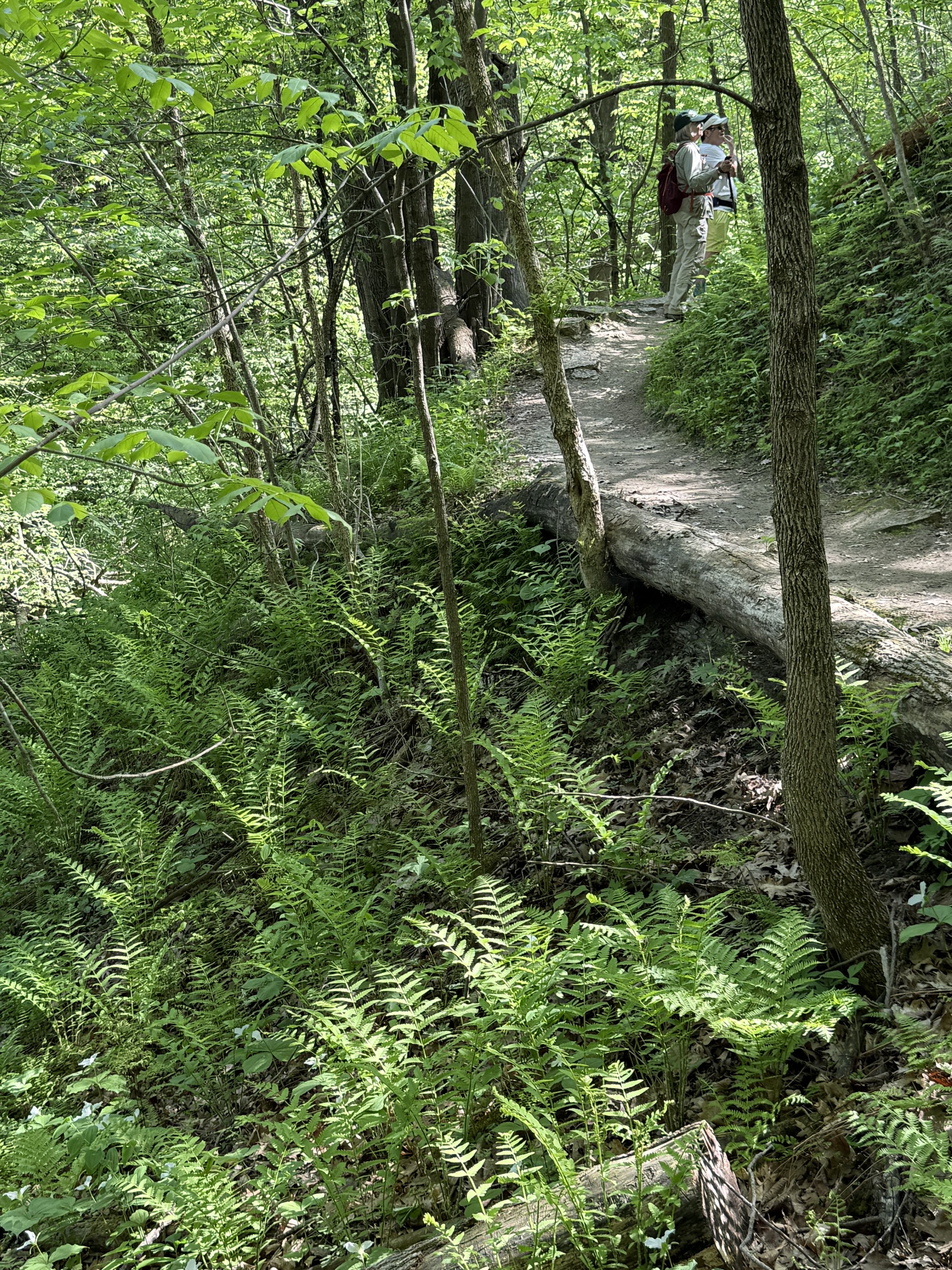
Fern heaven on the bluffside trails


All images, unless noted - Marge Loch-Wouters

Looking for more area hikes? Please stop by the web version of the blog and under the "Labels" tab on the right hand side of the blog, click on "find-a-hike". There are over 75 hike descriptions and lists of hikes to try!